Monthly Archives: Sep 2017

SE Sweden – Sandhammaren & Ystad

SE Sweden – Stopping to see the beach and lighthouse at Sandhammaren, walking the standing stones of Ales Stenar & visiting Ystad, Falsterbo and Kalgshamn.

On our space on the damp cobbles of Skillinge marina, we awoke inside a deep white bubble, visibility reduced to metres in the grey low cloud, full with rain.  With little sign of coming change, we sat out the worst of the continuing rain in bed then finally stirred for a late breakfast as the mist began to lift, ever so slightly.  Our first target to visit was Glimmingehus, a medieval stronghold turned museum that dominated all the local literature, as it was only a few kilometres from us.  We had a short look and wander around their shop, but didn’t pay to enter the grounds.  Instead we kept on moving along the coast to see Sandhammaren.  We parked up in the sandy car-park where several other motorhomes had overnighted, and walked first to see Sandhammaren Fyr and rescue station.  It was a tall skeletal red steel lighthouse with outbuildings that looked tired and forlorn in this weather.

Sandhammaren (lighthouse)

Sandhammaren (wild beach)

We retraced our steps to reach the wide sandy beach, said to be one of the finest in Sweden. Today, it was a little rainy with strong sea winds, and the frothing waves were breaking high right along the coast as far as we could see.  It was a wild, and invigorating sight, but not a place for us to linger too long.  Sandhammaren was established as a protected nature reserve in 1987, to retain the value of the area for both natural and cultural reasons. The beach is at the southernmost point of Sweden.  Beyond its fine sands and wild weather, it also has a sinister past.  Due to the many sandbars and spits, it was a popular stretch of coast for pirates to ply their trade.  They would use false lights to lure passing ships aground on the sandbars to then plunder their goods; the coast is littered with the corpses of unlucky or unwary ships.

Ales Stenar (stones from low level)

Ales Stenar (aaron at stone)

We drove next to Kåseberga, parking in the town in a large, free car-park from where we walked to view the main tourist site.  Positioned high on the steep coastline of Kåsehuvud is Ale’s Stones, or Ales Stenar, a large ancient construction of standing stones in the notional shape of a Viking ship, set out to reflect the annual movements of the sun.  It is Sweden’s largest preserved stone ship of this type, with 59 large standing stones precisely positioned to create the elliptical ship-like form, stretching to 67m long and 19m wide.  This type of stone-ship design has been noted in history annals since the early Bronze Age, from as early as 1100 BCE.  These specific stones are difficult to accurately date, but were likely erected in their current form by Vikings between 500-1000 CE.

Ales Stenar (stone ship)

Ales Stenar (nicky in stones)

Along with the symbolic boat form, the stones are also positioned to act as an astronomical calendar.  Certain key stones mark sunrise positions for each passing month, with the central end stone marking the Summer Solstice.  When viewed from the central position of the ship, the rising and setting sun traces a route across exactly one quarter of the stones at each solstice.  At each equinox, there are an equal number of stones positioned between day and night.  For a brief time we had the entire hillside site to ourselves and enjoyed walking between the tall stones, imagining the site as it may have been in those times.  We wandered over to the nearby cliff edge, looking both out to sea and back at the stones.  It was an impressive site.

Ystad (busy aire)

Leaving the Viking-laid stones in peace, we next doodled along the coast to reach the main regional town of Ystad, where we planned to overnight in a large, free aire with a view of the sea on the outskirts of town.  We found it quite busy, more so than most aires we’d passed in recent months, but still with plenty of room available.  After picking out a dry and almost level spot, we decided on a short walk to see the local beach, but would leave off exploring the nearby town until tomorrow.  The weather was poor, grey and damp, so we snuggled in and watched the sea boil and fluster for the comfort of Benny.

Ystad (colourful streets)

Ystad (town view)

Ystad (walk around towm)

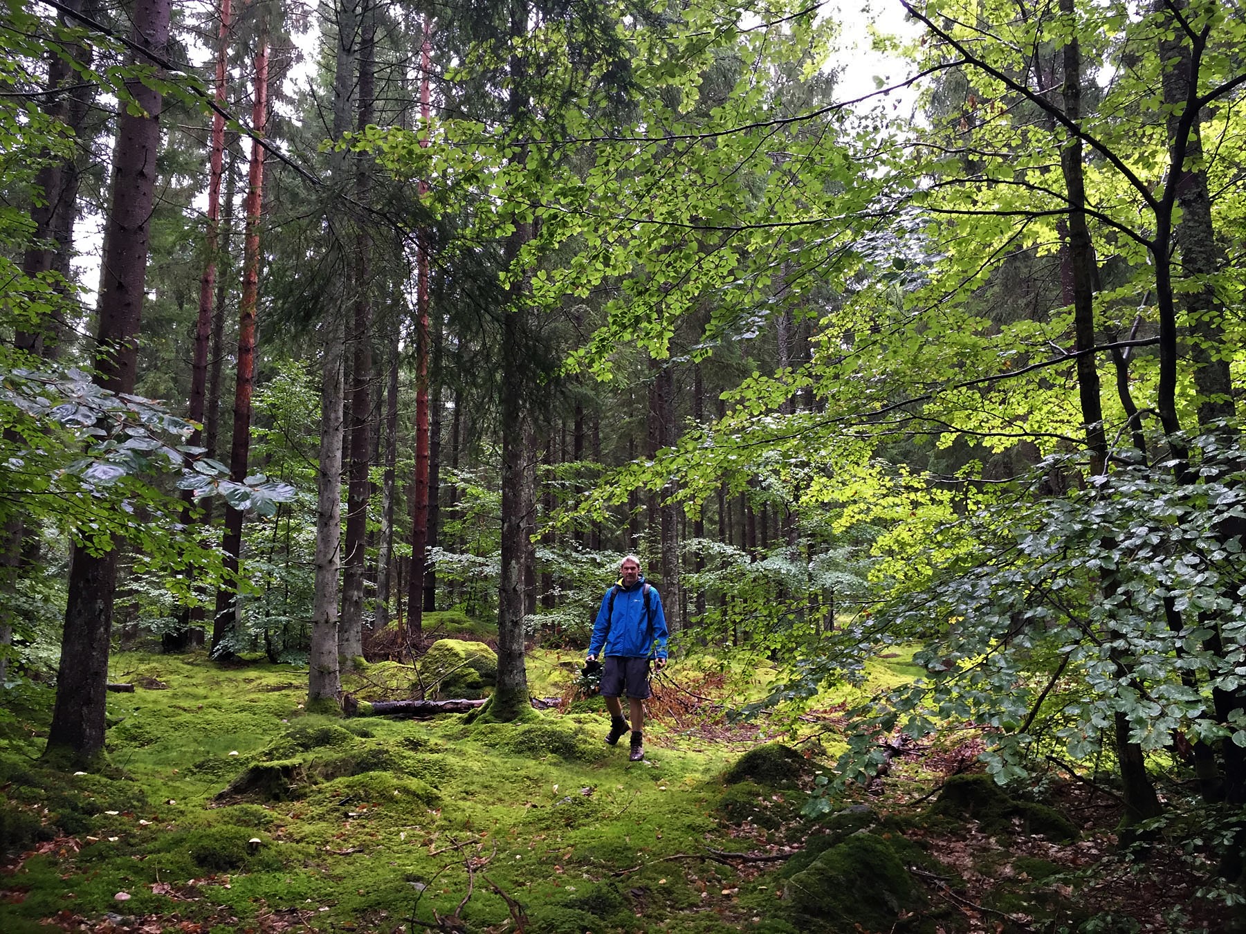
In the morning we walked along the coast into Ystad. We had no real expectations, not having researched it before arrival, but it turned out to be a surprising delight.  Once we had successfully negotiated crossing the rather restrictive coastal railway line, we wandered through the town with no goals or plans, happily enjoying its quaint neatness and the gentle exercise.  We found the lovely square outside St. Mary’s church and many pretty streets of colourful timber buildings, much like Ribe in Denmark.  After a decent, exploratory walk around the town centre, around 8km in total, we returned to Benny and spent the afternoon sketching and relaxing in the sun, looking out over the sea. We lazily sat here, wine glass later replacing pencils, until the sun set calmly over the sea.

Ystad (reading at aire)

Ystad (sunset from aire)

The next morning we moved on, first passing through the town of Trelleborg where we picked up a useful map, then on to Falsterbo on the south west corner of Sweden. Our newly-acquired map told us of long coastal walks around the headlands, so we found suitable parking at one small nature reserve car-park and set off for a long, flat walk.  We started out across flatlands similar to parts of Lincolnshire or Norfolk, peaty moorland and scrub woodland that was likely below sea level.  The land was sparse, the sky huge.

Falsterbo (on the beach)

Falsterbo (beachwalk to pier)

After a few miles we reached sand dunes and behind them a tiny sliver of sandy beach.  We followed the beach, passing a long timber pier, before cutting a little inland to skirt around a protected nature area, where we saw lots of bird-watchers, and a busy golf course.  A small lighthouse stood on the edge of the golf course.  From there we cut back along empty roads, through extensive residential areas with many beautiful, interesting houses.  This had the feel of a retirement village, with large neat plots, expensive housing and proximity to easy walks and golf courses.  We finally returned along a long, straight cycle path, to close our varied and interesting 16km loop of the coastal peninsula.

Kalgshamn (view of bridge)

Kalgshamn (harbour)

From here we drove north, to reach a large beach parking area, at Kalgshamn, about 10km short of Malmö.  We parked up, with only one other van in residence, and walked to where we could see the bridge leading across to Denmark.  This was, sadly, to be our last night in Sweden, after 51 days in-country.  We walked around the small harbour behind the beach to watch the slowly developing sunset.  We returned to Benny and finished off all our remaining wine in celebration of our wonderful times in Sweden, sipping thoughtfully with a view of the spectacular Öresund Bridge, our route ahead, ever onward, stretching out away from us across the misty white sea.

SE Sweden – Knäbäckshusen & Simrishamn

Following the coast further around SE Sweden to Knäbäckshusen beach & the town of Simrishamn, with a stormy overnight stop in Skillinge.

We were awakened early in our quiet Gyllebo lake swim-spot parking by a large group of kids undertaking what looked like an orienteering initiation, and thought it was best to move on so as not to be in their way.  We packed up and headed off, intending to move only a handful of miles between stops, looking in at all local walks and beaches.  We stopped first at a small car-park where we could walk into a nature reserve, but the walk was only 1.5km and led only to a picnic spot, so we decided it was hardly worth booting up for.  The day was looking much brighter, with an open blue sky and no wind, so instead we thought our time would be better spent in search of a beach to lounge on.

Knabackshusen (walk through village)

Knabackshusen (village end)

Knabackshusen (midsummers heart)

To reach Knäbäckshusen beach we walked through an entire relocated village, comprised of 17 houses that had been removed in totality from a newly formed military zone to make way for their firing range, and plonked down by the sea 15km away.  The 17th century houses were all quite different construction styles, timber, brick and render, but equally picture-postcard perfect, like a tiny Suffolk hamlet.  Their gardens were well-tended, replete with flowers and decorative plants, bounded by neatly painted picket fences. The end of the path leading to the beach was decorated by a large midsummers floral heart, long past its best now, but must have been a colourful delight in the early summer.

Knabackshusen (a at chapel)

Knabackshusen (chapel interior)

We passed a small chapel, its cobbled floor lined inside with simple timber benches and white-washed walls.  Above, a continuous timber wall-plate supported many smooth stones taken from the beach, marked up with names of visitors or pilgrims passing through. This tiny chapel was one of many stops on The Pilgrim Way- Skåne Blekinge, itself a small part of the incredible trek leading from the northern reaches of Norway all the way to Santiago de Compostela in northern Spain.  Each chapel or church on the vast route are said to be like pearls on a rosary, all rather insignificant individually, but together forming something greater.  We had day-walked a part of the route near Palas de Rei, but it was difficult to comprehend the dedication, or guilt, that could drive someone to walk all the way there from the northern wilds of Norway.

Knabackshusen (overview of bech)

Knabackshusen (the steps down)

The beach below looked spectacular.  It had a border of smooth, rounded stones with a band of white sand leading into the water.  Overhanging trees cast areas of light, dappled shade on small portions of the white sand, while other gnarled trees lay supine, their branches whitened by sun and waves.  We walked along the sands a while, marvelling at the easy, simple beauty of the stretch of coast and how fortunate we were to be able to enjoy it all to ourselves.  We found our place to relax and we settled in, laying down our towels.  We lazed, read and played, getting up for the occasional easy skinny dip in the chilly sea water to cool off.  The air was only around 19 degs but lying in the direct sun on the warmed sands we felt tropically hot.  The setting on the white sands with clear lapping waves framed by blue skies was simply exceptional, as good as any Caribbean island could offer.

Knabackshusen (beach tree climb)

Knabackshusen (beach selfie)

A few more dips and a few more hours of lazing on the sands kept us busy.  Nicky did a little pilates and this inspired me to do a few press-ups, but we soon exhausted ourselves and got back to simple, easy lazing again.  Only two squawking swans, dipping and diving in the water near us, disturbed our blissful silence. Around 1pm we began to lose the sun from our playful east-facing beach, lost behind the tall trees lining the bank behind us, so we sadly called an end to our beach time, packed up and wandered back to Benny.  We were very happy to have had a wonderfully lazy morning in the sun on such a beautiful and deserted beach.  This was one of those special moments you always remember.

Knabackshusen (a on beach)

Knabackshusen (n on beach)

We ate a quick lunch in Benny then drove another few miles to the next place of interest.  Only a short drive away we reached the narrow streets of the village of Vik and parked up on the water’s edge.  This long stretch of cracked sandstone coast, worn into tooth-like fissures by weather and time, was speckled with yellow lichen and many small sea pools.  We bounced along, up and down the jagged, broken rocks as we made our way to the Prästens Badkar, the Priest’s Bathtub.  This turned out to be a flower-like circular arrangement that was formed in the coastal rocks, likely by a sand volcano that lay on the seabed in the Cambrian period, over 500 million years ago.  A visiting priest was once said to have bathed in the geological feature after a long journey, hence the name.  We found it interesting but rather small and, after our beautiful sunny morning beach time, not especially inviting for a comfortable dip.

Prästens Badkar (a at priests bath)

Prästens Badkar (n at priests bath)

From here we visited the main town of Simrishamn for a short while, walking the streets lined with hopeful but empty restaurants, it easy to imagine them loud and busy in the height of summer.  A quick visit to the tourist office allowed us to pick up a few maps for upcoming areas.  We walked to the main square, passing the central red-brick Simrishamn church and its adjacent buildings. A further wander through the nearby pretty streets and along the side of the marina completed our whistle-stop tour of the region’s main town.  There was an aire at the marina, but it was a simple car-park and relatively expensive, so we decided to move on out of town and find a quieter spot.

Simrishamn (main square)

Simrishamn (church and statue)

We drove a few more miles then parked up to overnight on cobbles in the town of Skillinge, in a free parking area at the marina.  One cup of tea after stopping we watched the skies turn quickly from blue to cloudy to dark grey clouds to pouring rain in a few short minutes, glad to have made our parking spot in time for the deluge.  With this change of fortune in the weather we quickly re-planned our evening and decided to immediately open the wine we had picked up in Simrishamn’s System Bolaget and settled in to watch the burgeoning storm overhead.  It was difficult to comprehend that this was still the same day that we had lounged in the sun and swam naked on a stunning Caribbean-quality beach, but that’s motorhoming for you – the art of ever-changing fortunes and horizons.


SE Sweden – Friseboda & Kivik

Continuing our explorations in south-east Sweden, we visited Friseboda & Kivik, with days out to see beaches, arboretums and nearby national parks. 

After our blissful week in Långasjönäs camping, we finally packed up and said goodbye to our amenable host, and to our beautiful swim lake.  We drove south, with our customary Lidl stop on the way to restock our fridge after a week of sitting still.  Our SatNav was very confused for most of the journey as we crossed wide green fields, meaning the smooth, fast road we travelled on must be less than two years old. We passed many sign-posted options for nearby picnic areas, beaches and swim spots.  We finally chose one and cut left down a narrow, bumpy road, following tight bends to reach a large, empty car-park at Friseboda beach, a 5km long sandy strand on the Baltic Sea.

Friseboda (woodland trees)

Friseboda (woodland mosses)

We parked in the green embrace of the nature reserve.  We were surrounded by spacious, mixed woodland, replete with pine trees, with thick moss dominating the groundcover. Wispy lichen hung from branches and helped create a feel of ancient forest, and perhaps it is – the area has been settled, farmed and manipulated by man for over 7000 years.  We walked over pine-needle paths to reach the calm, clear sea.  With the exception of one elderly jogger, we had the long strand as far as we could see in both directions all to ourselves.  We laid a blanket out in the small dunes and settled in for some serious relaxing, interspersed with cooling sea skinny dips, reading and snacking.  The only sounds we could hear were the light buzzing of nearby insects and the soft lapping of tiny waves.

Friseboda (lunch spot)

Friseboda (n on beach)

Friseboda (walking along beach)

Late that afternoon we drove to Kivik, but the first possible aire we had in mind was mostly flooded, so we moved on to the marina parking nearer the town centre.  It was late Saturday afternoon and the aire was fully packed with vans, and we just managed to squeeze into a nice spot between two others.  We had a short walk around the town and the harbour walls, seeing several great swim spots and lots of birdlife.  A square housed the beginnings of a festival, with stalls and stands under construction.  We checked a local noticeboard and read about the upcoming Apple Festival.  It would not be starting for a few days, so the current visiting crowds were simply weekend warriors.

Kivik - birds on rocks

Havang beach (bikes at the beach)

Havang beach (a on the sand)

The next day we cycled from our spot in Kivik to Haväng beach, a rare area of sandy steppe, caused by dry climate and lime soil, where the Verkeån river runs into the sea.  We reached the beach by dirt road shortcuts across private land, avoiding the main roads wherever possible.  The beach car-park was busy with dog-walkers and visitors.  We cycled right along timber walkways and onto the grassy hillocks in front of the beach where we locked up our bikes and lay down, enjoying the sun on our backs and legs.  We could see the military base right next door and later watched Special Forces undertaking training manoeuvres and mock rescues on the sea in heavily armed rib-boats.

Havang beach (special forces)

Havang beach (tree roots)

Havang beach (nicky tangled)

On top of a small hill there were a few interesting trees with wildly twisted roots, all now above ground.  We played here a while, like kids, filled with memories of similar trees from childhood.  Near these trees was Havängsdösen, a Neolithic stone circle and dolmen grave site. We caught the distinctive aroma of wild curry plants as we walked over to see the standing stones. We walked the length of the beach and back to our original spot, then relaxed on the dunes to simply people-watch and read.  The sun remained out and the air warm; bliss.  Later we were passed by a string of Icelandic ponies being ridden across the sands, fording the river at its widest point as it entered the sea.

Havang beach (a on bridge over river)

Havang beach (river meets sea)

On our cycle home, we saw a gathering of red kites circling over the freshly-cut fields.  We stopped to watch them hunt, seeing them easily spotting the voles or mice disturbed by the farmer’s work.  We watched them glide, pause and then violently swoop, dropping almost vertically to pick off their prey in the short stubble at will.  It was a compelling site to see so many red kites circle the same field.  We cycled back on main road, before cutting back into Kivik and through, passing popular in-progress Sunday league football games, to visit Kiviks Esperöd arboretum.

Havang beach (ponies on beach)

Havang beach (red kite)

Leaving our bikes aside we walked the gardens, where we saw an old Swedish phone box set among the trees, its short swing doors open lattice design, Elven-like, a real contrast to Scott’s famous British equivalent.  We crossed an arched blue bridge set over waterlily-rich waters that reminded us  a little of those in Monet’s Garden in Givenchy.  The ducks happily sunning themselves on the banks quacked us a greeting. We walked many tiny paths around the arboretum’s perimeter, finding all manner of exotic trees from all over the world, and simply enjoying the wander.  We returned to our parking spot in Kivik marina to find a new motorhome beside us.  Our new neighbours were Brits, originally from Peterborough but now of Morecombe bay.  It was the first British van we’d seen in a long time so we had to stop for a chat.

Kiviks Esperod (bridge in arboretum)

Kiviks Esperod (old phone box)

Next morning we packed up and left the now almost-empty aire, saying goodbyes to our British neighbours on one side and to a black BMW with a full set of interior curtains and someone sleeping inside on the other.  We drove only a short distance to Stenshuvuds National Park, in Österlen, where we parked up at the central Naturum building, the visitor centre.  It wasn’t yet opened, so while we waited we hiked one of their marked routes to the south, 3.2km long through light forest and pasture land.  The sun was bright but the shaded trails in the forests were still sharp with cold this early in the morning, so we walked fast to keep warm, glad of the occasional hill to work up.

Stenshuvuds NP (lighthouse)

The national park covered quite small area at just over 400 hectares, but it packed in a lot of variation in both landscape and habitat.  Around half of the park was leafy deciduous forest, mainly gnarled hornbeams with a thriving population of hawfinches.  Pasture lands provided grazing for some wildly hairy, wild roaming highland cattle.  There were thickly heathered and flat sandy heaths, wet and dry meadows and peat-rich mosslands all providing a rich variety of ecosystems for the many creatures and endangered plants of the region to live in.  There were a number of well-marked trails through the park, and we followed several of these in turn, taking in the ever-changing landscapes beneath our feet and around us.

Stenshuvuds NP (forest traisl)

We clambered over leafy trails and tree roots, large boulders, deep sandy paths and marshy bogs by still, dark lakes. The hornbeam forest was cast deep in light and shadow by a bright, low sun, with lichen covered boulders lit up like beacons when in full sunlight.  We climbed timber steps to the ancient hill fortress of Stenshuvud, at the grand height of 97m, where we enjoyed views out to sea from a rocky plateau.  We passed Stenshuvud lighthouse and old cottages still used by eel fishermen as they have been since the 18th century. We reached a beautiful white sandy beach and felt drawn to dip in the water, but we abstained for once.  We returned to the Naturum building and ate lunch in Benny, glad to have taken the time to visit this wonderful nature reserve.

Gyllebo lake - swim spot

Only a few miles further on, we stopped at a dedicated swim place on Gyllebo lake and decided to overnight there.  We parked in the corner of the small car-park and walked out to explore their wonderful set-up, with pontoons and ramps reaching out into the pristine lake.  A couple of large fire pits were provided to allow cook-outs, along with many benches, making it a tranquil, but also popular picnic spot.  There were local cars buzzing around most of the afternoon, dog walking and picnicking, and it was good to see the area being put to such good use.  It had chilled down and the wind had picked up a little, so our desires to swim here were dampened somewhat.  Later we walked out to the swim platforms to watch the sun drop behind the black treeline on the banks of the blood-red lake.

Sweden – Långasjönäs Camping

Spending a week in an off-season ASCI campsite in Långasjönäs, our days filled with swimming, cycling, walking and running, interspersed with some quality downtime.

Leaving the nature reserve at Almö, we headed to Långasjönös as planned.  This happened to be the place where our batteries ran out, wound down like the non-Duracell bunny, and we simply had no desire to drive any further.  We availed ourselves of a cheap ACSI deal, with the additional carrot of 7 nights for 6 on top of that.  Then we sat still, almost alone on the edge of the campsite, taking stock. This was to be a week of lazy reflection, under somewhat rainy skies. There were two short road loops within the campsite, the first served area the site of many long-terming caravans, some occupied and some not, but the second area was empty of casual visitors, so we parked up on the only flat site we could find, peacefully excluded and content on our private half of the campsite.

Langasjonas- (our pitch)

Langasjonas- (local trails)

We begin our casual exploration of the area with a 13km cycle around the main lake, following fire tracks and simple off-road trails through the forest.  At one clearing we passed a large gathering of cars and people in the woods without ever discovering what event was occurring, but it was something quite popular.  We rounded the top of the lake and returned south on the western side, more removed from the shore and on a relatively traffic-busy road.  We passed an old 19th and early 20th century drinking water treatment works and reservoir in the leafy village of Froarp, now dry and grassy but with well-preserved stone culverts and a decorative pump-house building.  From here we re-joined the dedicated cycle routes that brought us along gravel trails and home to the campsite.

Langasjonas- (checking the water)

Langasjonas- (swim pontoons)

That afternoon the weather brightened, so we decided on what became a 1.2 km swim around our nearby headland.  We suited up, even though the lake was a relatively balmy 19 degrees, and entered the water at the swim pontoon at a neat sandy beach.  We swam to the left, the smooth, fresh water and my injured shoulder both feeling good.  We hugged our nearest coast, but not too close as the lake remained shallow for a long distance out.  The sun was on our faces and the banks lit up, everything looking tidy and bright.  Turning the corner near to where we would exit the water we surprised two young local girls happily sunning themselves on a large flat rock that stretched from their beautiful home’s garden right down into the water.  I think we were quite the novelty to them as we passed.

Langasjonas- (on the pontoon)

Langasjonas- (ready to swim)

Langasjonas- (n in water)

The next morning we went for a 21km cycle into the nearby town of Karlshamn, to both explore the town a little, and to pick up a few fresh provisions.  We followed the easy bike trails south, mostly alongside the main roads, until we reached the outskirts of town.  From here we skirted around the water’s edge, seeing the more industrial side of town, reaching the tourist office and passing through the cobbled market square.  The streets of the town were set out in a grid pattern, a layout that made it easy to find your way but left something wanting; it felt anonymous, even with neat, pretty buildings all lined up, it lacked the spirit or centre that pervades a typically knotted medieval town.

Langasjonas- (cycle to Karlshamn)

We devised a plan to swim a round trip to a faraway island we could see from the pontoon.  We had walked to it the previous day on a short ramble and thought it would make a good target for a longer swim.  We entered the water, stopping briefly at the central floating pontoon in the centre of the lake that was used more by ducks than swimmers.  The water was sweet and clear, but a tail wind was chopping the surface at our backs and we knew the return journey would be much more challenging.  We reached the pretty tree-covered island, passing it on its left shore, where we spotted an easy place to climb ashore.  We wandered through the trees in our wet-suits, where we found signs of a fire in a small clearance, the island perhaps a popular camping spot for local canoers or fishermen.

Langasjonas- (swim to that island)

Langasjonas- (reachng the island)

Langasjonas- (on an island)

After our island explore we re-entered the water, completed our circumnavigation and continued on our way back.  As expected, the rough, choppy lake took more effort to swim into.  There was little respite from the winds on our swim home, having to work a little harder, swallowing more of the fresh, tasty lake than planned.  We returned to the same spot on the beach pontoons and exited the water via steps, feeling good.  The swim back took us less time than going, even though it was into the wind, as without all the heads-up sight-seeing and excitement of our island adventure, we simply got on with it.  It was a 2.5km round trip in total, our longest swim since the Arctic Circle.

Langasjonas- (island rest)

Langasjonas- (swim ending)

During our stay we kept an eye on the night sky.  Even though we had travelled a long way south, the nights were now quite dark, and on days with no cloud cover there was always a possibility of seeing the aurora.  One clear night around 11pm we walked out to the floating swim pontoon, with its wide view north up the lake.  We stared up at the northern sky, seeing a multitude more stars than we ever would in the light-polluted skies near home.  But we were too far south now even to catch the glittering edges of the aurora, so it would have to have been hugely active and us exceptionally lucky to mange to view it here.  We still had a long, peaceful moment under the starry night sky.

Langasjonas- (n at papermill ruin)

Langasjonas- (old paper mill)

Another time we followed a long forest trail walk north, the soft ground heavy with rotting leaf-fall and peppered with a multitude of different mushrooms.  A deep blanket of discarded pine cones and needles covered much of the forest floor, with other areas thick with luminescent green mosses or sun-loving lime-coloured lichens.  We passed the ruin of an old paper mill, built over a weir on a small river feeding into the lake.  We scared a large gathering of ducks by walking across the timber bridge, then in turn they scared us right back with their rapid squawking flight out from under our feet.  As routes led on through more deep forest, we wandered off the paths, marvelling at the quantity and variation of mushrooms sprouting up everywhere and wished we had knowledge to forage properly.

Langasjonas- (exploring forest)

Langasjonas- (forest mushroom)

When we reached the shores of a nearby, much smaller lake, we passed a small opening that led out along some slippy narrow planks, through a bed of reeds, to a small square timber pontoon floating in the lake.  Nicky decided that she needed to have a refreshing dip to help both cool her off from the walking and cleanse her of a minor but niggling hangover.  She stripped off and jumped in, yelling briefly with the chilling shock as she met the water, but was soon luxuriating in the silky freedom of the beautiful lake and peaceful surroundings.  Not to be outdone, I had to have my own lake skinny-dip later on the walk, a brief yet refreshing swim at a small beach area near to our base.

Langasjonas- (small lake swimspot)

Langasjonas- (n gone swimming)

We ate a few times in the service block kitchen and lounge, cooking our meals there and setting a neat, formal table, just for the variation.  There was an area for cooking with lots of sinks, ovens and hobs, an area for dining with many tables, and an area for relaxing with books or TV.  Amazingly, we saw no one else use the facility in the time were there, so it became an extension of our van, our own extra living room area.  There were comfortable settees and a TV with English-speaking channels where we could catch up with the news as we relaxed post-dinner.  One rainy evening we watched a movie on our laptop in the lounge, it suffering much less percussion noise than Benny.

Langasjonas- (a skinny dip)

I completed four books whilst resting here, a reflection of the time we had to simply sit and do what we enjoy. I went for a short run while Nicky walked the nearby trails to find a comfortable spot to sit and sketch a mushroom.  I passed her three times on my short running loops, each time stopping in to check the progress of her drawing.  We had a 1.9km swim on our penultimate day, a wider sweep following our first route around the headland to the right.  This time we crossed the lake first, then skirted the opposite bank, checking out the beautiful properties that lined the grassy shore. The water was much calmer, barely a breath of wind disturbing the surface – swimming perfection.

Langasjonas- (n after last swim)

Langasjonas- (a on rocks)

Motorhoming is such a different life when you stand still, rather than the constant rush of daily discoveries.  No driving, no planning, no sights to see, no moving on.  After a week in Långasjönäs we really felt we had gotten to know the area in detail.  We had walked, ran or cycled most of the local trails, had had three long swims and a few dips in the lake, and had visited the main town of Karlshamn.  This form of static exploration brought forth a narrower but deeper pool of discovery, within which we began to find a greater connection to Swedish nature.  Our extended stay opened the way to living with casual freeness and with easy accessibility to the calm waters we have come to crave.


SE Sweden – Kalmar & Almö

Sweden’s South East coast – Kalmar & Almö

Crossing the long bridge from Öland, we returned to revisit the town of Kalmar, the inescapable point where the island’s only bridge meets the mainland.  We parked near to the 13th century fairy-tale Kalmar Castle, proclaimed as the best preserved Renaissance castle in Sweden.  A large anchor marked the beginnings of the castle’s defences, set on the banks of its deep protective moat.  We entered the extensive grounds, a purpose-built island complex, via a flag-lined wooden bridge over the moat, taking in the views in all directions.

Kalmar - (approaching the castle)

Kalmar - (on the bridge)

The original tower was constructed in the 12th century, with the ring wall fortress following in the 13th century, making the tower one of Sweden’s most impenetrable fortifications.  Due to its status as a key strategic site over the straits leading to the Baltic Sea, the castle faced many wars over the centuries.  The defences were strengthened again in the 16th century with four cannon towers added.  The 18th century saw the castle utilised as a prison, distillery and supply depot.  It is now managed by the Swedish National Property Board, as a site of important cultural heritage.

Kalmar - (n and the castle)

Kalmar - (defensive cannons)

Kalmar - (castle and moat)

We circled the castle grounds at both low and high level, enjoying the first hints of blue skies we’d experienced in a long week dominated by little but muddy grey rainclouds.  We passed cannons on the ramparts, had views out to sea over strategically important islands where other formidable forts had once sat, and learned of the important, formative history of the site’s defenses.  It truly was an impressive place, balancing the precarious need of strong barricades with a wish for elegant beauty.

Kalmar - (internal courtyard)

Kalmar - (castle and moat view)

Leaving Kalmar and its fairy-tale castle behind, we drove on south to the celebrated, historical naval town of Karlskrona, on the south coast of this region of Sweden.  We first visited services on the edge of town, where we filled and emptied, and took time to wash the worst of the filthy sprayed mud off Benny, the wet roads having turned his pristine white coat a muddy grey-brown.  We then turned our attention to the town, it looking very industrial and initially unappealing from our outsider’s perspective across the grey water.  We arrived in the town centre at 4pm, just when the town’s parking restrictions end, so we had our free choice of places to park.  We found the nearby tourist office and were helpfully gifted a town walking route map and proceeded to follow this route, to gain a feel for this nautical town.

Karlskrona - (Main square)

Karlskrona - (church in square)

Karlskrona - (statue and church)

There was certainly a more interesting architectural and cultural dimension in the heart of the town than the rough, industrial feel our first impressions had offered.  Created from scratch on uninhabited islands, the stone fortress was built in the 17th century as a necessary Naval Port on the Baltic Sea, to act as an efficient centre of excellence for the then dominant Swedish navy.  It built and maintained ships, it trained, fed and housed sailors and organised the navy crews.  Karlskrona was added to the UNESCO World Heritage list in 1998, as the most complete example of a European Naval base planned in accordance with the ideals of 17th century maritime knowledge.  It remains the sole active naval base in Sweden, still producing modern submarines and renowned surface vessels on site, the island neatly divided into a civil north and a military south.

Karlskrona - (street with flags)

Karlskrona - (maritime musuem front)

Karlskrona - (diving boards)

We began in the main square, Stororget, before moving along flag-strewn streets of pretty timber buildings all housing boutique shops or cafés that reminded us both Bergen and Stavanger.  Our route crossed to another small island, Stumholmen, where the new Maritime Museum, completed in 2014, was situated.  It had closed for the day, but we looped around its stainless steel clad walls and passed by the moored ships outside, then through to the adjacent grassy picnic park with its public swimming spot, complete with high diving boards.  We saw Sweden’s last remaining wooden aircraft hangers, in use for storing and maintaining military seaplanes from 1914 until 1949 and now simply preserved for future generations.

Karlskrona - (maritime museum gardens)

Karlskrona - (timber aircraft hangars)

Karlskrona - (clock tower)

We followed the coast-hugging path past small lighthouses, impressive municipal buildings and statues of notable local dignitaries to reach the Admiralty Church and the pyramidal clock tower in the nearby park. We returned to the Great Square, Stortorget, and revisited the facades of the impressive Trefaldighetskyrkn and Rådhuset.  The vast, elegant square was originally conceived as a monumental public space to rival the grandest of those in France or Italy, set out to classical architectural ideals.  Unfortunately, the twin requirements of modern convenience and tourism have turned it mostly into a very grand car-park.  We examined the centrally positioned statue of Karl XI, watching possessively over the busy square, before tailing off our walking tour and returning to Benny.

Karlskrona - (Admiralty church)

Karlskrona - (n with preacher)

Karlskrona - (main square carpark)

There were a lot of other places of interest to see, but time was pressing on and we wanted to arrive at our next aire before nightfall.  After months of midnight sun and long, bright evenings, we were struggling a little with the sudden arrival of dark, gloomy nights.  Sweden in sunshine has been the perfect outdoor playground for us, our favourite country for swimming, hiking and canoeing, but in dreary, persistent rain under dull, grey skies, it holds only the sadness of potential unfulfilled.  We drove out of the town on the main road to Malmö and turned west, before cutting south on a small road to reach the island of Almö.  A large portion of this thin island was designated as a protected nature reserve and we had hopes the weather would lighten up and allow us to explore it, at least a little.

Almo island - (rocky headland)

We found a grassy aire with its own beach and direct access to walking paths to the south, and decided to sit here a few days as we awaited some drier weather.  We undertook a short walk on the first night, to take in our local surroundings.  The moss-covered rocks and tall, twisted trees tangled with pistachio-coloured lichen had the feel of an ancient landscape, something from the age of dinosaurs.  We followed the well-worn footpaths that led to areas fully set up with fire-pits and makeshift benching; clearly a popular summer hang-out on the shores of the lake, but there was no one here but us on this damp, grey September day.

Almo island - (a on walk)

Almo island - (rocky moss)

We had a longer walk the next day, following the rocky, moss-covered coastal path past several fenced off military zones and through more dark trees heavy with hanging lichen.  We saw and picked blackberries, a reminder we were at the beginning of autumn.  Some trees were beginning to turn, a hint of golden yellow on their leaves.  We reached a long causeway at the end of the Nature Reserve that led to the next island, but there was no obvious way to walk further other than on the road, so instead we turned and retraced our steps along the rugged coast.  We considered a swim in the chilled, choppy lake, but on this occasion our lazy sides prevailed and we opened a bottle instead.

Almo island - (lakeside wander)

After a slow morning under more rain clouds, we slowly packed up and left the grassy aire, heading on westwards, in search of a quiet campsite to sit out the weather in relative comfort.  After some deliberation, we headed in the direction of Långasjönös, a nearby ACSI campsite, with our committed intention of relaxing there for a little while.

SE Sweden – Nyköping & Öland

Sweden’s South East coast – Nyköping & Öland

Leaving Stockholm and the Vasa behind, we drove south to arrive at an aire near Nynashamn, a simple, remote gravel lay-by that held the potential for local hike walks into the surrounding nature reserve.  These were not really feasible with the now torrential, incessant, muddy-puddle producing rain we were driving through.  We thought at least, as the only inhabitants around this night, we’d have a quiet, restful sleep.  In defiance of our thoughts, a large double trailer lorry pulled into the open site at around 11pm making all sorts of noise.  After finally quietening down, it then left noisily at around 4am after running its growling engine for twenty very long, sleep-disrupting minutes.

Nykoping - (waterfront)

Nykoping - (castle)

The heavy, plodding rain continued the next morning, so with little else to do but move on, we headed on south to Nyköping.  There was a free aire here at the marina, complete with electricity, and we dodged large, deep puddles full of floodwater to reach the only remaining dry pitch.  Our neighbours had seemingly parked up on a sunny day, and then confidently left for a day of exploration elsewhere.  Their van was surrounded by soft fabric-covered chairs and other camping accessories, left outside and now drenched in the centre of a deep muddy lake.  A few hours later they returned and surveyed the carnage, and had to move their van and gear, piece by sodden piece, to another part of the car-park away from the muddy flood.  They did not look overly impressed.  During a brief respite in the weather we walked along the river into the centre of Nyköping, where we visited the Tourist Office before dawdling around the market square and seeing the local sights.  We stopped into an old castle that was closed for the season, but we could still walk through the stone courtyard for a brief look.  There was precious little else to be seen.

Oskarshamn - (considering a swim)

Oskarshamn - (pre-breakfast dip)

We serviced then kept on south as we hoped for a break in the weather.  We passed through Norrköping town as we went, and headed on to Oskarshamn, then turned inland to park up at an aire at a public swim place on the banks of a pretty lake, near Berga.  The site parking was very sloping but being the only visitors we found a flat area in the centre and settled in, watching the choppy lake from our window. We had a short forest walk in the rain where we saw locals foraging for mushrooms.  The swim site was well provisioned, grassy and neat, with floating L-shaped pontoons reaching out into the lake, providing an easy way into the deeper waters whilst also creating a secure, sheltered area near the shore for younger bathers.  It even had a specific pontoon designated as a dog bathing area.

Oskarshamn - (swim before breakfast)

Oskarshamn - (returnng to a warm Benny)

We sat out the night with the rain continuing as before, but the morning brought a welcome break from the watery percussion and we decided to embark on a pre-breakfast swim.  The air was cold with a light, wet mist still hovering over the surface, and the water chilled from the recent rains.  There was some hesitancy as we paced along the creaking pontoon, attempting to convince ourselves this wasn’t a silly idea, but an inspired one. We fought the shock of entry as our skin instantly chilled on breaking the calm, reflective surface, but with the initial shock over we settled in and enjoyed a wonderfully refreshing float.  We swam short distances out and back, Nicky more vigorous than me, as I was wary of over-stressing my still damaged shoulder. The easily forgotten rain suddenly began falling again, light and slow, as we emerged to dry ourselves on the pontoon.  We quickly returned to Benny for a warming shower before devouring, suddenly famished, our hearty breakfasts.  It felt good to have (mostly) dodged the rain for a more rewarding and immersive wet experience.

Oland Island - (windmills)

Glad we had made something of this short opportunity between almost- constant downpours, we returned to the road and headed next to the large town of Kalmar.  Only passing through, we filled up with fuel and tasty treats from Lidl’s bakery before crossing the 6k causeway bridge to the long, thin island of Öland. The north of the island is predominantly flat and agricultural with diverse coastal meadows, the southern half a large, flat limestone plateau that, due in part to the extent and complexity of its flora, creating a valuable ecosystem for nesting birds, has been granted UNESCO World Heritage status.  We stopped to examine a few of the many timber windmills and prehistoric burial sites scattered around the island, the main points of interest on our route. We drove down the west coast road before cutting across the middle of the island to the east coast at Torngård, where there was a small parking aire in a neat coppice of trees near the sea.

Oland Island - (black sheep)

We went for a short beach walk, following the coastline south.  It was a rough, smelly, wind-swept emptiness, an area of bleak scrubland with no tall features, trees or buildings, just a scrappy, repetitively barren vision stretching on to the horizon.  It was mainly grazing land for animals, and we found it very different from the rest of Sweden we’d visited; desolate and bare, and whilst it is a bird-watchers paradise we were not left especially moved or impressed.  The on-going deluge from the grey skies may have influenced our perception of this ancient landscape, and under a bright sun it would surely have held more of an interest for us.  We settled in again for another grey, rainy night, but this time with an invigoratingly wild view of a foaming, stormy sea.

Oland Island - (licking cows)

We were awakened early by cows noisily licking the back of our van, mere inches from our heads, having parked just a little too close to the fence behind for comfort. We had to roll forward a little to avoid the continued attention and the cows eventually lost interest in us.  We drove south, to the very tip of the island beyond Ottenby, to visit the lighthouse, Långe Jan, and the attached bird sanctuary.  There were a lot of cars visiting, mostly filled with keen, well-equipped twitchers here to photograph or simply enjoy watching the extensive range of birdlife along the headland shore.  The Naturum display building on site was also awash with excited children, a visiting school class.

Oland Island - (lighthouse and nature reserve)

Oland Island - (defensive lighthouse)

We browsed the exhibits and played with their interactive migration simulation, before chatting to an enthusiastic member of staff about the work they do.  Many varied migratory species pass through the rich waters of southern Sweden on their travels to South Africa or beyond, returning each year to the same spot.  The centre have set up light, almost invisible nets in their gardens, to carefully capture birds flitting between trees, so they can be recorded and tagged before their release.  They also have walk-in traps on the rocks at the shore, where certain species of birds wander through a tight entrance they cannot return through, allowing them to be collected and ringed.  The nets and traps are checked every 20 minutes to avoid any prolonged distress to any caught birds.

Oland Island - (naturum display)

We stroked a ruff that had recently been trapped and ringed by the sanctuary.  It was a young male in tawny beige and drab brown colours, the lull before the colourful storm of display feathers he may choose to grow later in an attempt to attract females.  The species is unique in birdlife, in that there are two distinct routes a male can choose to follow in pursuit of a mate – they can ruff up, develop a multi-coloured display and defend a territory with the hope of attracting females with their colourful antics, or they can stay neutral coloured and homeless, travelling between many other territories, attempting to pick up loose females along the way.  Both choices have distinct advantages and disadvantages in their drive for progeny.

Oland Island - (birdwatching)

We walked a long loop back to where we’d parked, watching the many birds being watched by many, before continuing back north along the west coast of the island.  The sun was out, the sky was clear and blue, and the island was looking much more inviting, but no less flat, than on our arrival. It had been a nice diversion to see a little of these wild lands on the east coast of Sweden, but we were now headed back to the mainland to continue south.