Monthly Archives: Aug 2017

Saltstraumen & the Atlantic Coast Road south

Leaving the Lofoten Islands and following the Atlantic Coast Road south, passing Saltstraumen, Mo I Rana and Trondheim to reach the outskirts of Oslo.

We said our goodbyes to Mummy Finch and the Lofoten islands and headed along the E10 in the direction of Narvik.  We’d already had a long drive from our base on Vestavågøy to reach the airport drop-off at Evenes, so had no desire to push on too far.  We started looking for a place to pass a quiet night, and we found a suitable place at our second attempt, at a small marina in Bjerkvik.  It was a little scruffy but it was also supremely quiet and we parked overlooking the water on a beautiful still evening.  The overnight fee was an honesty box noting that they would be delighted if we chose to donate 50 NOK (about £4.50), and we were glad to.  We had drinking water and could have had electric too if we parked on the other side of the groin, but preferred to forego that in preference of a sea view.

Bjerkvik Marina - sunset

Later a group of four backpackers, couples from both Poland and Germany, turned up looking to camp on the only patch of grass on site at the marina, which meant right by where we were standing.  They politely asked permission from us, as if we could or would refuse, but this endeared them to us immediately and also earned them a slice of yummy fruit cake each.  They invited us to sit around their improvised cooking fire, but we were tired and opted for an early night.  The following morning we gifted them cereal bars and carton drinks, as they looked malnourished and because we felt guilty that everything was so casually easy in Benny and camping was just such hard graft.

Road to Narvik

Storoya - coast at aire

We followed the coast of the fjords and the North Atlantic, arriving in the northern hub of Narvik soon after.  We had considered making this a base for a week of local activities, but after we stopped for an hour we decided to push on, instead stopping at an island aire at Storøya to sit out the newly arrived rain.  The next morning we caught a short ferry across to Bognes, then continued the route south, arriving in the town of Fauske in early afternoon.  This was to be our only paid aire on our long journey south, in a motorhome-only area of the neat seafront of this pretty town.  We took the day to catch up with shopping and reorganising Benny back into order.  We also decided to skip the regional centre of Bodø in favour of a quicker route south. Our first stop next morning was at Bobil-Nord, a local Benimar dealer where we checked a few warranty issues with their helpful staff then it was on to Saltstrumen.

Fauske - artwork

Saltstruman - boat trips

Touted as the world’s strongest tidal current, the Saltstrumen is a narrow 2km long channel between two deep fjords.  At its peak flow, under a full moon, the tide drags over 400 million cubic metres of water through a channel only 150m wide, causing a wildly powerful maelstrom with eddies and whirlpools popping up erratically in the rushing force of water.  We watched, transfixed at the swirling power of the surging incoming water, some areas looking more like a hot fissure below the surface was boiling the water. We half expected Godzilla to rise out of the wildly bubbling water.  Tourist-loaded boats skirted the whirlpools with familiar ease, utilising the central thin band of smooth current as a respite between excursions into the extremities of the frothing fray.

Saltstruman - mountain view

Storvik beach

The jagged mountains behind formed a stunning back-drop to the continuing maelstrom, moody and grey against the sky.  We watched one brave fisherman in a small dingy with a wheezing outboard slowly cutting through the flow, heading upstream.  A few hundred hard won metres later his chugging engine cut out and in the time it took him to restart it, he had been forced back beyond the point where he’d started.  We walked up to look at what we thought was a visitor centre, but it was closed, the grass uncut and external seal enclosure area outside empty and dried up.  The whole place carried an air of sad abandonment.  The building itself looked quite new, so perhaps it was a seasonal thing and had closed up for winter, but in mid-August this seemed a bit of a stretch.

Hovden Tourist aire - glacier

Hovden glacier - close-up

Hovden - breakfast with a view

We pushed on south, eager to make good time, passing through Storvik and Oanes to reach the aire at the Hovden Tourist centre, directly overlooking Svartisen, Norway’s second largest glacier.  We passed a lazy afternoon and a colourful night watching the light change on the glacial tongues and undertaking short local walks.  We ate our breakfast under the gaze of the glacier and a clear blue sky before driving the short distance south to catch the early ferry to Ågskaret.  On board we floated past a large Polar Circle marker, denoting that we had now left the Arctic Circle, again further south than we were many weeks ago when we completed our Arctic Circle Swim.  We stopped in at several nice aires with ample parking and beautiful sea views, but we decided to overnight at Stokkvågen museum, where we had the opportunity to see the ruins of a fort, complete a coastal walk and visit a nearby sandy beach.

Road to Halsa

Ferry to Agskaret

Passing Polar Circle marker

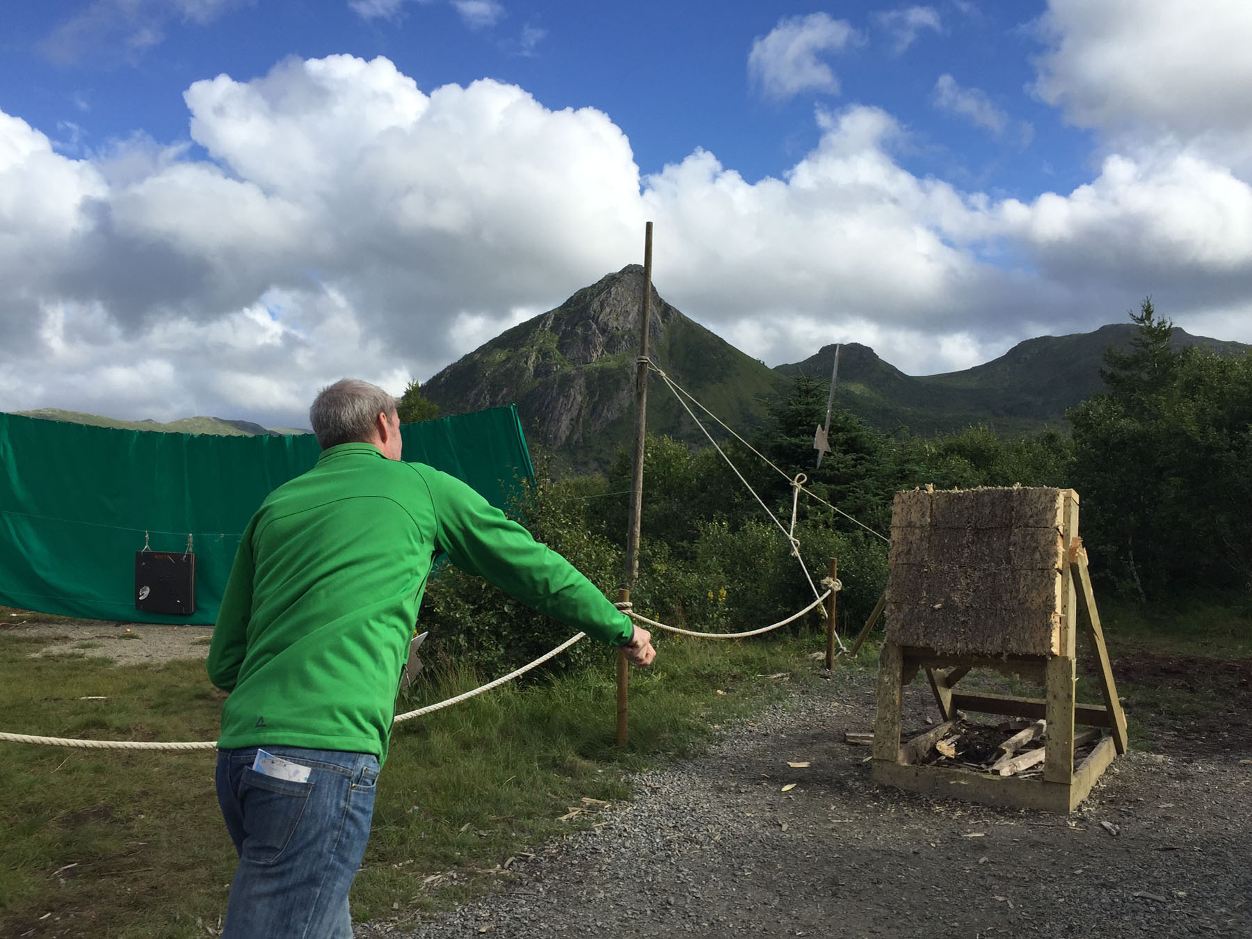
We walked up the hill to see the fort ruins, clambering into the creepy old tunnels and seeing the bases of the gun emplacements.  The views out to sea were far-reaching.  We walked around to the wide bay with the sandy beach with all intentions of swimming, but a biting cold wind was whipping though the bay and this discouraged us from undertaking more than a paddle.  We wandered in the shallows looking at crabs and small fish that darted around our ankles as they slowly turned white with cold.

Walking beach at Stokkvagen

Stokkvagen beach - paddling

Stokkvagen rock pool

Stokkvagen hot-tub dip

We walked instead around the stony headland, and happily found a wonderful, sheltered rock pool filled with sun-warmed water.  We stripped and dipped here, in our own personal hot-tub with a fantastic sea view.  Refreshed, we returned to Benny for a quiet dinner, before spotting a wild sunset out the window.  We clambered back up over the ruins of the fort to view the spectacle from a height, marvelling in the full, deep red glow that reminded us of Île de Ré.

Stokkvagen sunset view

Stokkvagen sunset

We woke early and moved quickly on, leaving the coastal National tourist route Helgelandskysten for a more inland and quicker, straight route south.  We passed through Mo I Rana only to pick up some shopping, before eating up the miles south on a straight, empty road.  We spent a few minutes at the tourist-trap of Laksforsen waterfall, before reaching Grong many miles later.  We crossed a blue metal bridge into town and parked in a very pretty parkland picnic area only a few minutes from the town centre.  The heavy rains in Norway that seemed to follow only a few moments behind us every day arrived on schedule so we spent another evening listening to the patter on our roof.

Next morning we arrived back in Hell, crossing our initial Norway east-west path as we now moved North-South.  We skirted around Trondheim picking up a few tolls on the way, before stopping in to a campsite at Kvikne.  After a few minutes looking around we decided it wasn’t for us, so continued on.  We were seeing wide fields of golden barley for the first time, sparking memories of Ol’ England. The road was more gentle and Sweden-like here, no majestic peaks or deep blue fjords, just hundreds of miles of easy rolling, tree-lined tarmac.  We arrived at a large lay-by picnic aire just short of the busy town of Tynset.  Here we enjoyed a quick walk to the nearby lake side before the inevitable rains began in earnest and we hunkered down for the night.

Giant elk statue

Nicky with Elk statue

The following morning we followed a long, flat, smooth and (some might say) boring road, making fast progress with nothing but trees for company. We saw two young elk cross the road in front of us, reminding us to take care and stay alert on these stretches.  Colourful, striped elk antlers were hung from trees as artwork to both brighten the trip and act as a subtle reminder of the dangers of migrating elk, a call for drivers to remain vigilant. We stopped in at a rest area to swap drivers, only to find we’d chosen the place where the world’s largest Elk statue, created in shiny stainless steel and standing at a height of 10.3m (and a length of 11.3m), stood proud.  It was impressively formed and provided a dominant reflective presence in the midst of an otherwise solid green band.

Andelva aire

We continued on to another roadside aire at Andelva, where we enjoyed a long walk around the adjacent lake coast to reach a small marina on the opposite side.  We picked wild blueberries in the surrounding woodland and enjoyed a bit of quiet downtime.

Winding roads, ferries, maelstroms, glaciers, rock pools, beaches, lakes and sunsets. Eight quite variable days and over 1100 miles away from our stay in the Lofoten islands we were finally parked up less than 50km from Oslo; we had made good time whilst seeing lots of interesting sights, managing to experience a lot of the central region and also rest well along the way.  We were recharged and ready for a few days in the big city.

Lofoten Islands (Part 2)

Spending a week exploring the Lofoten Islands with special guest Nicky’s mum

Lofoten Islands (Part 1)

DAY 5 (Saturday) – Eggum coast + beach walk

This day we planned a more local explore, so we headed west a short while before turning off the E10 to follow a narrow road around the headland in the direction of Eggum. We reached the end of the road and paid a voluntary 20 NOK to continue along a gravel track and park up next to a stone fort ruin.  There was a closed café built into the side of the small hill the fort sat on, within a stone circular courtyard outside.  We braved the high winds to look around the fort then set off to walk along the path by the sea front.  We soon came upon another of the notable artwork installations that dominate the tourist literature, such as the previously visited The Man from The Sea. This one was a partial statue of a head, layered and cut back from various perspectives.  It was much smaller than expected from photos of the artwork, and distinctly disappointing.

Lofoten - (At Eggum cafe)

Lofoten - (N meets the sculpture)

Lofoten - (silly in Eggum)

We followed the path that led past a deep lake surrounded by high, craggy mountains with sharp ridges that reminded us of Helvellyn in the English Lake District.  We reached a point a few kilometres along where we could view into the next valley, a scene lit bright by the sun escaping through an occasional break in the clouds.  The day was grey and overcast, but the air was fresh and there was a wonderful, light-enhancing glow that belied the weather; perfect for painting or photography.  We all sat on a nearby rock to enjoy the view before returning the same route back, the strong cross winds still blowing us sideways all the way.

Lofoten - (resting on the rocks)

Lofoten - (white sand beaches)

Lofoten - (n skips on beach)

Lofoten - (beach walk)

We tried to visit Eggum’s sandy beach but could find no way to access it, but a few kilometres out of town we found a parking place at a small harbour and walked back along other similar beaches.  The white sands and large, sea-carved rocks made these beautiful stretches of sand resemble those in the Seychelles, or the Western Isles of Scotland, especially when the sun came out and lit them up.  We enjoyed a wander and scramble across the sands, the temptation to swim never too far from our minds.  Instead we headed back home to set up for a party.  Today was designated as Nicky’s mum’s ‘on tour’ birthday, as we’d not yet be home on the actual date in September.  Starting with G&Ts on the terrace, we had birthday balloons, candles and a home-cooked meal planned.  We found and played a few tense games of the Viking board game Hnefatafl as many more drinks were rolled out and a night of drunken, giggling silliness soon followed – what better way to spend your 70th year on our beautiful planet?

Lofoten - (Gnt on the terrace)

Lofoten - (playing games)

Lofoten - (the giggles begin)

DAY 6 (Sunday) – LOFOTR Viking Museum

We waited until Sunday, the final day of the annual Viking festival, to visit LOFOTR, the Viking museum.  The weather was kind that morning, and with the site less than 15 minutes from our cabin we arrived and parked up right on time and were amongst the first visitors through the door. The reception building was bright and modern, its curved glass roof structure based on the Viking longhouse. Shops lined the sides of the central seating area.  We decided to see the outdoor items first as the weather was bright and dry, so bypassed the audio-guided museum and headed to the reconstructed longhouse.  The building dominated the site from the road, nestled solidly on top of a hill as if growing directly out of the earth.

Lofoten - (the longhouse)

Lofoten - (viking museum foyer)

The approach uphill showed off the longhouse building wonderfully against the sky.  The timber detailing of the doorways and carved roof tiles added a level of convincing authenticity to the recreation.  We enjoyed the attention to detail, as even when modern life intruded on the longhouse, insisting on statutory fire escape signage, it was made tongue-in-cheek as a running Viking man complete with helmet and sword.  Inside we explored the various rooms and chatted to the costumed staff, before playing dress-up with Viking clothes and weaponry.  Nicky’s mum posed with an axe, wearing heavy chain mail that was quite a complication to remove.  We lay on a bed lined with thick, soft furs, saw intricate deep wood carvings and swung axes and swords with abandon; it was quality, child-like fun.

Lofoten - (in the longhouse)

Lofoten - (chain mail and axe)

Lofoten - (a swordplay)

The main festival tents were at a remote portion of the site, on the banks of a lake. We walked there, passing foundations from discovered Iron Age settlements and a stone pen with two huge boars and their many cute piglets.  There were market stalls within billowing white tents all over the bottom site, selling all manner of items from jewellery to knitwear to bows and arrows. We visited the blacksmith hut with hope for a demonstration, but the smith was struggling to light his forge, even with his inauthentic cigarette lighter, so we left him to his struggles.  We passed another Viking who loudly announced his upcoming story-telling intentions in the boathouse, so we headed there to listen.  We were seated and regaled with ancient tales of adversity and intrigue, of mischievous Gods and the hapless or greedy mortals who fell foul to their scheming. It was a great thespian performance.

Lofoten - (storytelling)

Lofoten - (viking ship awaits)

Outside the boathouse we had spotted a Viking ship, awaiting its crew.  We put on the necessary life jackets and hopped on board, and when enough others followed we were set to sail. The wind had picked up to such a level that the long oars were discarded and our lake circumnavigation would rely solely on travelling under sail.  The square sail was quickly raised, caught sharply in the wind and the ship took off, cutting through the water at a rate of knots.  The expert guys sailing the ship trimmed the sail and jibed with the wind in order to achieve an out and back route by sailing close to the wind, the best way to manage the strong wind conditions in a simple way with a dozen guests on board and a limited time slot.  Seeing the traditional striped Viking sail taut in front of a lovely green hilly landscape and rippled sea was simply beautiful.

Lofoten - (we are sailing)

Lofoten - (tehe viking ship)

After our exhilarating sail, our next stop was to try our hand at both archery and axe throwing.  We shot weighted arrows from long-bows at the target boards only 15 metres or so away, nicely clustering them on occasion.  The ‘axes’ were formed from a single piece of cut metal, a little bent and blunt, so were much harder to control, but we managed a few satisfying throws that sunk deeply into the battered fibrous target.  We returned to Benny for an hour to grab a bite of lunch, and during this time the rains returned, dampening the day. This was our cue to now visit the internal exhibitions, so we collected audio guides and walked the display rooms, listening to descriptions of various items. We watched an informative and moving short film on Viking life, all filmed on site, some rooms being familiar to us from our morning’s explore.

Lofoten - (axe throwing)

Lofoten - (n archery)

Lofoten - (fire juggling)

We returned to the festival site where we browsed the stalls before watching the Viking ship sail by again. A puppet show, all in Norwegian, entertained us until the festival finale began, with fire-juggling, music and wonderful soulful singing drawing the day to a close.  We returned slowly back via the longhouse and reception and returned home tired, full of Viking memories.

DAY 7 (Monday) – Ballstad fishing village + Haukland beach

Today we headed west again, first to the town of Leknes.  We simply passed through again, before turning of south to visit the fishing village of Ballstad.  We parked up on the empty harbour front and walked a little around the town, but with a constant light drizzle in the air we found little to inspire us.  There were colourful houses and huts across the water, somewhat reminiscent of Tobermory on the Isle of Mull.  We completed a slow loop of the central village through what was mostly residential areas, deciding which pretty house we’d prefer to live in, and why.  It was a nice walk to clear away the cobwebs from the previous night’s exuberance.

Lofoten - (Ballstad harbour)

We headed back north of Leknes, this time turning onto a different headland and following the road around to visit Haukland Beach.  The rain was on with a force by now, coming in sideways in sheets.  We had a bite of lunch as we sat out the weather and enjoyed watching the wildness roll over the beach outside.  We thought we could fit in a short walk in a window when the rain had quietened, but as soon as we were far enough along the sands, the heavens opened fully again and we got utterly drenched on the beautiful beach.  The wind blew the rain at us from all angles and we couldn’t have been wetter if we’d had a dip in the sea.  It was strangely invigorating and exciting though, even if we were all a dripping mess on return.

Lofoten - (Haukland beach)

Lofoten - (soaked on the beach)

Still damp but feeling alive, we headed back home to spend a cosy afternoon, our last, in the quirky red cabin.  We mostly packed up and readied ourselves to leave, eating and drinking up all the remaining provisions, our week on the Lofoten Islands at a close.

Day 8 (Tuesday) – Return to Evenes and goodbyes

We cleared up and headed out, saying our goodbyes to the red cabin and, for the final time, disappeared down the narrow coast road.  We joined the E10 and retraced our steps back through Svolvær and beyond, passing all the familiar places and viewpoints we had stopped at on the way in.  We made good progress and had enough time to pause in a picnic place for a last lunch together before Mum’s flight was due.  We chatted about the islands, disappointed that the weather had driven so much of our experiences and activities, but still excited about the parts we had managed to include; beach, coast and mountain walks, Viking ship sailing, axe wielding, sea swimming and a special birthday meal.

Lofoten - (the road back to Evenes)

We left mum at the airport and said all our goodbyes, until our return to the UK for a pit stop in a few months.  We were two again, back on the open road and now with exactly nothing in our diary until mid-October.  What to do?  We guessed it was time to turn ourselves south and see what the central west coast region of Norway had to offer.

Lofoten Islands (Part 1)

Spending a week exploring the Lofoten Islands with special guest Nicky’s mum

DAY 1 (Tuesday) – Via Evenes Airport to a small cabin on the coast at Evensjker

We finished up our trip around the Vesterålen islands and drove in the direction of the airport at Evenes. Nicky’s mum was flying out to meet up with us for a week or so, having hired a small traditional, rustic cabin for the three of us to base ourselves deep in the centre of the island chain on Vestvågøy.  We had a false start at the airport as mum missed her connection flight in Oslo airport due to a delayed first leg, and had to await the next flight up that evening.  We called and asked if we could hang out at the single room Airbnb place she had booked for her first night (with us parking in our motorhome outside) and they helpfully said “no problems, help yourselves”.  So we relaxed for the afternoon in the warm sun by the small private beach at the pretty timber cabin as we awaited the arrival of the later flight.

Lofoten - (relaxing at cabin)

Lofoten - (GandT on beach)

After a quick swoop to the airport, we returned successfully, with mum on board, to the cabin to settle in for the night.  We had a short wander on the beach in the evening light, the girls with their essential G&Ts after the stressful and tiring travels of the day.  We caught up over a later dinner and chatted about the proposed activities and adventures we anticipated in the week to come, although disappointingly the forecast weather was looking like spoiling the party.  Still, we vowed we’d make the best of it all regardless, and with Norway weather, you never know.

DAY 2 (Wednesday) – Via Svolvaer to the Red Cabin

We had a relaxing breakfast, then tidied up and started out for our main base for the week, on Vestvågøy.  It was a long and very pretty drive, initially following Tjeldfjorden for many miles.  The scenery was not at its wonderful best due to the damp, grey morning, but it was still spectacular enough for new visitors from Lincolnshire.  The miles melted away as we passed mountains and lakes, crossed bridges and escaped long tunnels, all the while following the E10 west.  With no timescale binding us, we stopped at each special tourist viewpoint in turn, where we absorbed the expansive views and fresh air and enjoyed the opportunity to stretch our legs.  We stopped in for a look at the island capital of Svolvær, but found the town itself rather uninspiring.

Lofoten - (first viewpoint)

Lofoten - (lake walk)

We found another local walk nearby that we thought might be more interesting, and after a short drive to a nearby lake, we parked up at a Red Cross Centre and walked out along a stony path to the shores of another, much larger, lake.  The route would eventually lead to a camping cabin deep in the mountains, but we would only cover a short portion of the walk to a small beach area, before turning back.  Almost the entire path was built up in timber walkways, making the going underfoot easy and the navigation trivial.  We were able to pick wild blueberries from just off the route to have as tasty snacks as we walked.  It was very pleasant to spend some time in the great outdoors.

Lofoten - (arrival at cabin)

We drove on to Vestvågøy, then turned north off the E10 and followed a small coastal road for a few miles to find our little red cabin.  Its setting was lovely with a huge mountain backdrop and the fjord waters close on the other side, with huge ranges of jagged peaks opposite.  Unfortunately, inside the cabin was quite a bit more rustic than we had hoped for, with its last interior decoration seemingly having been carried out at the turn of the previous century, certainly not this one.  The electrical circuits were all max. 10 amps, so the electric heaters had to be turned off before the kettle could be boiled, and the oven, shower or washing machine could all only be used one at a time.  We must have tripped the house around thirty times during our stay until we understood every nuance – not exactly ideal.  We made it as homely as possible with the addition of all our gear, some colourful balloons and lots of food and booze.

Lofoten - (benny and cabin)

We had a short walk along the local coast road after dinner, enjoying the continuing light evenings, to see if we could find a local beach.  We could see the stony coast of the fjord but frustratingly there was no obvious public access to it, and the fields we could cross were all fenced.  We’d been told in Norway just to make your own path, but jumping fences seemed a step to far, so we would have to find alternative places to swim, if the opportunity to arose.

DAY 3 (Thursday) – The Road to Å

We awoke after a deep, long sleep to find the morning was simply perfect; it was bright and clear, with an almost cloudless sky framing the high granite peaks set across the fjord from our cabin.  We had all agreed to undertaking a long road trip today, to the very ends of the island chain.  This would also help us get our bearings and perhaps identify any wonderful spots that we may wish to return to later in the week.  We stopped soon at a high viewpoint to take in the view, before dropping down a hill where we passed the Lofoten Viking Museum.  We were happy to note it was only 15 minutes from our cabin, as we’d definitely be returning there on a coming day.  We passed near to Leknes town but kept moving onwards, eyeing up a stop on Flakstadøya island, at Ramberg beach.  We parked in a circular car-park and walked the short path to the sands and wandered along a while, enjoying the pretty bay.

Lofoten - (A at Ramberg beach)

Lofoten - (on ramberg beach)

After such a wonderful start the weather had slowly become dull, cloudy and overcast, but the rain stayed off for our entire trip down, and with the occasional bright sunburst escaping through the clouds we were treated to glimpses of the raw beauty of the Lofoten islands.  We had short stops at several viewpoints on the quite busy route, feeling like proper sight-seeing tourists for the first time in months. We reached the beautiful fishing village of Reine and instantly recognised it as the cover photo on our Norway travel guide.  We stopped a short distance out of town for a few photos, but we were double-parked and couldn’t find anywhere else to stop to allow us to walk around the village.  With little other option we kept moving, weaving our way along the narrow coast road, passing Moskenes, to arrive at Å, the last very town on the road.

Lofoten - (Reine overview)

Lofoten - (approaching Reine)

Lofoten - (town of A)

We parked in the large car-park with many other motorhomes and decided on a cup of tea before exploring, and in the time it took to boil the rains began, heavily falling and fully dampening our determination to hike the path the ends of Moskenesøy.  Instead we had a short explore around the town before beginning our journey back along the same road, in very different weather.  The clouds had absorbed the distant mountains and encroached on the nearby fjords, giving the whole region an ethereal glow, leaving us glad we had taken the time to stop at each viewpoint on the road down.  We made it back to our red cabin and had a relaxing dinner and a few drinks over the evening, whilst watching the every-changing view and colours of the surrounding fjord and mountains from the warm safety of our living room windows.

Lofoten - (on the way home)

Lofoten - (sneaky whisky)

DAY 4 (Friday) – Henningsvaer

After a long day’s driving west to Å, we headed east this morning, only a short way along the E10 road we had arrived on before turning south to head for Henningsvær.  Almost immediately after turning of the main road we spotted a wide sandy beach, and we had to stop to appease the swimming instinct of our visiting mummy.  She had a burning desire to have a dip somewhere within the Arctic Circle, and weather be damned, here it was to be.  Mum changed within Benny and, towel in hand, walked down the beach past a group of Spanish tourists wrapped up in scarfs and gloves like it was mid-winter.  She walked into the chilly sea and swam a while, as she loves to do, and on exiting the water was greeted with a rousing and heartfelt round of applause from the Spanish onlookers.

Lofoten - (swim beach)

Lofoten - (in the water)

We continued on into the fishing village of Henningsvær, where we parked up in a very tight space and walked around the pretty town.  We continued through the harbour and out onto the stony headland behind, passing under rows of tall timber racks constructed for drying stockfish.  Cod has been dried here in a similar manner from perhaps as long as 6000 years.  Beyond them we climbed up a rippled stone hill, riven with long cracks and fissures, to reach a small view point adjacent to a tiny red and white lighthouse building.  The views out over the fjord and back to town were magical, even under the dull, dark skies we were experiencing.

Lofoten - (Henningsvær)

Lofoten - (cod drying racks)


Lofoten - (view behind Henningsvær)We drove back along the same road, the rain beginning to spit, in search of a short hike we could all undertake.  We found a nearby climb to a pretty lake, and despite the rain we decided to give it a go.  The start was along the main road, not ideal, but we soon turned to face the mountain, only to find a large boulder field and a difficult scramble that proved a little too much from mum. We got a short way up, enough to give great views back over the bay below, before retracing our steps back to Benny.  We decided that was sufficient exploration for one day and headed back home for a relaxing evening.

Lofoten - (hill climb)

Later this Friday night the ladies had planned a special beach trot (or tolt) on Icelandic horses under the midnight sun, but the persistent drizzly rain and, more pertinently, high cross winds, led to the ride being cancelled.  We waited each subsequent night to see if it would be rescheduled, finding out only a few hours before if it was to be on or not, but unfortunately it was cancelled again and again.  This could have been a real highlight of the trip had the weather been kind, but unfortunately it was not to be.

To be continued – part 2 to follow.

Andøya – Stave & Andenes

Driving to Andøya Island where we wild camped near Stave and visited Andenes

Leaving Nyksund, we drove deeper into the Vesterålen, through Sortland again and north to the island of Andøya.  We drove first to Bleik camping with the intention of staying there, but found it to be just a steep, scruffy field all really crammed in with caravans, and it didn’t appeal to us at all.  We moved on instead to Stave camping, where we had previously eyed up the opportunity to hire one of their grassy mound hot-tubs and thought this could be the time.  But on arrival, this also disappointed; the site was small and rough and the hot-tubs dirty, as well as being on the wrong side of the main road for casual dipping into water at the beach.  Their flyers had sold us a dream but delivered much less, so we preferred not to give up our money to either campsite and went looking for a wild camp spot.

Not far along the road we spotted a large patch of gravel at the end of a long pitted track.  It was far enough from the road to be quiet, and our position would be discreet, so we slowly bumped up the short road and settled in.  We were later joined by a solitary German lady and her inquisitive sausage dog, parking up near us in her very old motorhome.   Much later, in heavy rain, a BMW pulled up near us and, as we wondered what they were planning, out came a small tent and they pitched it on the sodden gravel as they readied themselves for a damp night.  With their tent up, they remained sitting in their car most of the night until it was time to brave the cold tent for sleep.

Matind - (the walk begins)

Matind - (cold mist envelops us)

The weather had been awful all day, with a solid, low-lying mist that never burned off, but blew around quickly, teasing us that it might leave, but returning just as quick as it departed.  We had vaguely planned to undertake either a puffin tour or a whale-watching trip, but the visibility was so poor we decided it was not worth the trouble or expense.  We had found a local hill walk instead, and were waiting for a burst of motivation to go.  Late morning we saw a brief weather window and chanced it, all the while thinking that we’d most likely turn back on the walk if the mist returned and closed in.  So we quickly packed up and drove off, carefully rolled though the huge craters of our entrance road and headed for the start of the walk.  We passed two cyclists being followed above by a tracking drone, filming their progress through the damp fog.  We doubted it was the most iconic footage they recorded during their cycle tour of Norway.

Matind - (on the edge)

Matind - (above the mist)

We parked on a small stopping place and quickly bounced up the obvious path leading though some light trees, before the weather had a chance to change its mind.  We were heading for Måtind, a small hill at only 408m high, but an isolated grassy bump with steep cliff faces on three sides, making it seem far more imposing and spectacular than its height suggested.  The low mist was thick and fast flowing, like a bubbling white soup.  Nothing was visible in the valley below us, and only a few local green peaks rose high enough to escape the blanket of white and be lit gloriously by the sun.  Occasionally, with a stiff bluster from the wind, the fog escaped the valley bowl and spilled over the saddle of the mountains in a fast moving wave, encompassing everything in its perfect whiteness.  We got caught a couple of times in this foggy overspill, but it cleared again quickly like a retreating wave on a beach.

Matind - (valley in cloud)

Matind - (mist layer in valley)

Matind - (n on the top)

Reaching the higher areas above the top level of the fog afforded a magical view across the top of the cloud blanket.  We couldn’t see the pristine beaches we knew were directly below, but the fragile, ethereal nature of the meandering fog created for us its own special spectacle. There were no other walkers around anywhere on the hills, the fog in the valley forming a barrier between us and them as we climbed ever closer to the highest point.  We enjoyed a long stop at the top, marvelling at the wide-ranging views above the fog and our glorious isolation on this island peak.  Once we began heading down we were soon engulfed in the white mist, our skin chilled in its cold grasp, and the path was difficult to see.  We made it safely back down without seeing much of anything, very glad to have had our special time above the whiteness.  We were also pleased to have manufactured ourselves a decent, interesting hike on a rather grim day when it would have been so easy to stay snugly inside Benny.

Matind - (cliff edge in cloud)

Matind - (the summkit plateau)

Matind - (together on the top)

The next morning we thought it important to visit Andenes, to close off the loop of where we would have been if we had impulsively jumped on the departing ferry at Gryllfjord, back on Senja Island.  If we had taken it, this ferry would have deposited us in Andenes a few weeks ago, to continue the main national tourist road.  Today our route took us past another built viewpoint where we stopped a while to look out to nesting gannets and cormorants on some nearby rocky islands.  We then drove on into Andenes and stopped briefly near the tourist office for a look around, but we saw nothing beyond what we had expected from a ferry port town.

Andenes - viewpoint stop

Deciding we had seen enough of Andøya, we departed for the south, passing by Sortland again on our way to overnight at the marina at Lodingen.  This stop was a quiet, pretty place, with vastly oversized plots that caused no end of confusion to late arrivals who thought it would be fine to park on empty parts of already occupied spaces.  It was popular and over-subscribed but they could easily accommodate many more motorhomes with a more sensible approach to spacing; we parked central to our designated plot and had five metres each side remaining unused, and twice a newcomer tried to fit in between us and the next parked van, but were moved on by the site warden.  We had a rather futile walk into the town then a short clamber up to the small lighthouse behind the aire, before retiring for an early night.

Lodingen - giant bicycle

Lodingen - harbour aire

We were heading back east in the direction of the airport at Evenes, where we had a very special visitor flying in to join us on our travels for a week, and together we planned to explore the Lofoten Islands.


Norway – Nyksund & Dronningruta

Leaving Ringstad, driving to Nyksund village & walking Dronningruta (The Queen’s Route) the following day.

After saying our goodbyes at our WorkAway in Ringstad, we were back on the open road for the first time in ten days.  We hugged the coast clockwise, our first stop just short of the small town of Staume.  We paused a while near a small museum so we could walk up to the The Man from the Sea statue, a tall installation figuratively representing the local fishermen of the area. The 4.5m high cast iron statue initially divided the community, it being loathed and loved in equal parts, but as the symbolism of its form was more understood and disseminated, it has slowly become an integral and respected part of local lore. The elongated form allows a high view out to sea, keeping watch over fishermen at work.  Its giant feet deeply rooted it to the land, as an anchor would a ship.  It holds a light aloft, to help guide the fishermen safely back home, a crystal that glows blue in arctic winter light.  Even its controversial penis signifies the continuity and family-focused nature of the local fishing communities, with skills, knowledge and craft being handed down over generations.

Man from the sea (view out)

Man from the sea (in context)

There was a photographic display of other artists’ works, but very few of them were of the same emotive quality as The Man from the Sea.  We would see a few others in later days and be a little disappointed at each, from either their small size or from a lack of imagination perspective.  We moved on, followed the road along the winding coast before turning left up another finger-like peninsula to reach Myre.  After a quick shop for some fresh provisions we pushed on northwards, where the road became a hard, pitted dust track.  For five slow miles we bumped along it, with the sea on our left and high cliffs tight on our right, until we reached our goal; the once-abandoned but now quirkily revived village of Nyksund.

Nyksund (wharf buildings)

Nyksund (harbour view)

We squeezed into a narrow strip of hard-standing alongside a few other motorhomes, just a few hundred metres beyond the busy car-park.  We all lined up neatly with noses looking out to sea, snuggled in tight, like a display row in a showroom.  Happy with our spot, we walked across the causeway into the centre of Nyksund for a quick explore.  Nyksund was a traditional fishing village that, due to the use of larger fishing boats that were unsuitable for its small harbour, was depopulated and eventually abandoned.  The town lay empty for over thirty years before a German man organised to have discontented youths from Berlin live and work there to help reactivate and redevelop the site.  It has since become a haven for artists and other creative types and that in turn has brought an influx of tourists, supporting the cafés, restaurants and guest houses scattered around the harbour; a self-perpetuating cycle.

Nyksund (town and aire)

There were several nice art galleries in town, but only a few artists displaying works that we found of interest.  We browsed some small shops, filled mostly with junk and postcards.  A large mural brightened up one small square where locals chatted as they cooked sausages on a gas stove.  Many of the buildings were still in their renovation phase, with boarded up windows and in desperate need of paint. The town as a whole was still in need of much more investment and time; we found it scruffy and tired, but perhaps others believed that was an essential part of its charm.  We climbed the small hill to visit the community church, a quaint timber structure with a simple, yellow interior, bright and airy.  From here we saw three expedition kayakers loading up and leaving for a multi-day excursion, waving goodbye to well-wishers on the shore as they paddled out of the calm harbour into a choppy sea.

Nyksund (sunset in bay)

Seeing the thriving community in Nyksund was interesting, but our main goal here was to walk the Dronningruta, the Queen’s Route, one of the top rated hikes in Norway. The mountainous circular loop could be joined only a short distance from where we had stopped, so we could start the hike straight from Benny in the morning.  That evening we had one short walk to stretch out legs as the red sun fell into the glowing sea.  We wandered over a small rocky hill that offered us a wonderful view back to Nyskund village and of our comfortable wild-camping aire.  A tail of fluffy clouds glowed pink above the stone causeway and the distant grey mountain slopes looked lit from within.

Dronningruta - (first climb)

Dronningruta - (mountain views)
We slept well, too well, and awoke much later than expected. Ten days of actual work must have made us a little more weary than we’d realised. We ate breakfast, packed up a lunch and finally started our trek around 11.15am, under a bright, hot sun and cloudless sky.  Like at Besseggen Ridge, we’d lucked out again with perfect weather on the day we had a long, iconic hike planned.  The route rose sharply from sea level, up a well-worn dirt path flanked by low, pink heather.  We were soon sticky with sweat and silently cursing the sun cream running off our foreheads and into our eyes.  When we could see them through blurred, stinging eyes, the views were quite spectacular.

Dronningruta - (cairn with a view)

Dronningruta - (nicky at cairn)
After the steep scrambled climb we reached a long grassy plateau with panoramic views out to sea and beyond to rows of faint snow-capped mountains.  This was the area of the Vesterålen Islands that we’d just left and, further behind, the distant Lofoten Islands where we were heading to next. We followed the marked path, seeing only a handful of other walkers, and a few fell runners, spread out across the mountain.  We’d expected the renowned route to be busy, especially in such glorious weather, but we were happily surprised to have it mostly to ourselves.

Dronningruta - (plateau walk)

Dronningruta - (us on rock)

We ate our lunch on a flat rock looking out to sea, picking out a few small lighthouses built on the rocky skerries far below.  A few boats glided past, looking insignificant in the expanse of ocean surrounding them.  Far below to our right we could see the small fishing village of Stø, overlooked by some sort of radar monitoring station. We descended down a steep path to reach the road just outside of the village, before turning left to follow the walk back along the coastline.

Dronningruta - (the route continues)

Dronningruta - (a on the path)
Dronningruta - (n looks over islands)

On this lower return leg we soon crossed Skipssarven beach, a wonderful curved stretch of white sand set at the bottom of high cliffs.  We had noticed it before from the cliff top before descending to reach Stø village, and it was even more pristine and inviting up close.  There were people camping on the grass just behind the beach, and with such a quiet and beautiful spot in the bright sunshine we were momentarily jealous of those who sleep under thin canvas in such natural surroundings.  Later we would remember why we no longer do, and our jealousy would turn to pity once the wind and rains returned and we saw other campers struggle in a deluge.

Dronningruta - (skipssanden beach from above)

Dronningruta - (approaching Sto)

Dronningruta - (Sto village)

Dronningruta - (Skipssanden beach)

This stretch of coast was littered with large trunks of smooth, grey driftwood, scattered around the stony beaches.  Some had been dragged up to be utilised as makeshift benches, other parts formed bridges through the muddy areas of the well-worn path.  It was all much easier walking on the low part of the walk, and we quickly ate up the miles back as the view slowly changed.  Before reaching the last uphill stretch to close our loop, we reached a small, shallow lake set not far from the sea.  With no other walkers nearby, we decided on a quick cooling dip, and stripped off and slipped into the water.  It was smooth and warm and we relaxed a few minutes before redressing just as a group of seven walkers appeared over the stony hillock behind.  We shared a knowing smile with each other as we nodded our casual greetings to them.

Dronningruta - (view back to skipssanden beach)

Dronningruta - (skinny dip in lake)

Dronningruta - (getting boots back on)

We closed the Dronningruta circular route shortly after our swim, with a last climb up a narrow dirt path lined with rocks and twisted tree-roots to the sign-posted saddle between two small peaks.  From here it was an easy downhill back the way we began, until we reached the gravel road that took us back to Nyksund.  The sun was still shining but the wind was now whipping up white horses in the sea and it chilled us when we walked in the shadow of the mountain.  We returned to Benny a little over five hours after leaving and passed a second quiet night in the same aire, very contented with our iconic and very beautiful 17.5km walk.

WorkAway – Ringstad (Part 2)

Ringstad Part 2:  Cooling swims at local lakes, foraging for berries on local islands, midnight camp fires and mountain hikes.

Ringstad - (Seahouse from sea)

Ringstad - (island across still bay)

Our work continued day to day, with each day a simple variation on a theme.  The weather stayed bright and clear, the views out to sea remained spectacular, the beauty never diminishing with familiarity.  The restaurant was busy and the house and apartment turnover high, so there was always plenty to be done.  I chipped in with cleaning a house when required, but managed to avoid the kitchen or restaurant in favour of more outdoor gardening work.  Each night Nicky and I drank and chatted late with Karina, learning more of the history and future of their busy lives and business.  The more we heard of the wild beauty of the Vesterålen islands in winter, its pristine snow glistening bright under green aurora skies, the more we vowed to return.

Ringstad - (setting sun over sea)

Ringstad - (barbecue hut)

Ringstad - (pink clouds)

One night, after closing the restaurant, we all walked a short way around to a comfortable timber shelter and spent the remainder of the late evening barbecuing on an open fire.  The site was kitted out with woolly blankets, cushions and lots of seasoned firewood, all we needed for a good night.  The sun turned the sky pink over the barbeque place, reflecting the lines of coloured-in clouds on the still, dark water of the adjacent sea.  When the flames died down a little, we devoured tender slabs of steak and pork straight from the metal grill, with sides of various potato salads.  Afterwards we sat around the dying fire sipping red wine, chatting into the small hours under the midnight sun.  Nicky and I were the last to leave, reluctantly abandoning the fire and the mesmerising pink skies around 2.30am.

Ringstad - (firestarters)

Ringstad - (barbecue hut chat)

The next morning, after a few hours work, the full group of Workawayers decided to take kayaks out to visit a few small islands to forage for berries, and perhaps wild mushrooms if they were ready.  We all paddled as a group out to a nearby spit of sand joining two small islands and exited our kayaks, with empty tubs in hand.  We walked through the low, springy bushes searching for ripe cloudberries, but we were a week or so early, as we could only find hard red fruit on each plant.

Ringstad - (view from beach)

Ringstad - (foraging beach spot)

Ringstad - (a kayaking on calm sea)

To compensate, there were many ripe wild blueberries, so we picked those instead.  We then kayaked to another grassy island, again landing on a small sandy beach between pointed rocks.  We all foraged for blueberries and found there to be an abundance, and ate many as we picked.  The collected blueberries were later made into very enjoyable sweet dumplings by our lead kayaker and resident chef, Xervin.

Ringstad - (A & N kayaking)

Ringstad - (second beach stop)

Over the week, we had a few short sea dips to cool off from the heat of the day, lasting only a few minutes each time but we emerged from the chilly sea water cooled and refreshed.   One afternoon we had a quick cycle to a popular sandy beach set on the end of a local lake.  It was only 3km away, an easy free-wheel down past a few other small lakes, huge expanses of wild lupins and a neat strawberry farm.  The tiny stretch of beach was packed with families, the parents sunbathing and the kids playing raucously in the water.  We slumped onto the short grass at the side of the sand and lazed a while, then tried to have a swim in lake.  The only issue was the shallowness of the water, and we had to walk a long way out to get deep enough water to cover our knees.  It was perfect for small children to splash around in, but not ideal for a proper swim.  Still, it cooled us down very nicely in the warm afternoon sun.

Ringstad - (sunset on seahouse)

Ringstad - (pre-dinner drinkspot)

On our last day in Ringstad, we worked through the busy morning shift to help out, even though it was a scheduled day off for us. Mid-afternoon we borrowed our host’s battered old jeep to drive a short way around the coast to where we could begin a climb of a nearby peak.  The 467m high hill, Vetten, had formed the solid backdrop of our stay and we had long talked of standing on its top to look down over the islands we had kayaked around, and the time was now.  It was a short walk, around an hour and half up to the top, with an initial steep climb turning into easy walking for most of the well-worn route.  We passed and examined a neat green cabin available for hikers to use before continuing up to the top of the hill where another small hut had been built for walkers to seek shelter.  We sat inside out of the chilling wind to eat our lunch, signing the scrappy visitor book as we took in the expansive view.

Ringstad - (view from Vetten)

Ringstad - (hut on Vetten)

Even on this rather dull, cloudy day, the setting was incredible; below us there were calm, protected bays scattered with rocky islands covered with green vegetation and nesting sea birds. It was an eye-opener to see the scale of the area in one vista.  Ringstad, where we had based ourselves, was visible on the end of a small peninsula, and we could just pick out Benny awaiting our return in the car-park behind the main house.  Ringstad was positioned on one of many small inlets scattered throughout this small tongue of the mighty fjord, with many other stretches of water and tall dark hills stretching to the horizon and beyond.  We could see why boat traffic and travel was so important here; a thirty minute jaunt on a fast boat to cross the fjord could be a three hour drive around the difficult, winding coast road.  Our high overview literally gave us a different perspective on the terrain we had immersed ourselves in.

Ringstad - (climbing Vetten)

Ringstad - (from top of Vetten)

Our ten days in residence in Ringstad proved to be a wondrous experience.  We worked hard, and played just the same, taking all kayaking opportunities, swims and hikes whenever possible.  The eagle viewing on the rib-boat nature safari was a visual treat, and the calm, ever-changing views of the surrounding inlet and far-away mountains were a constant delight.  We enjoyed the long chats with our hosts and our quiet, contemplative row boat trip under a cloudless sky.  We were hesitant to leave but equally hesitant to stay on, as we could easily have become trapped by the visual enchantments of such a place.  It was sad to drive away, but life is but a series of meetings and partings, that is the way of it, as a wise frog in a muppet movie once reminded us all.