Tag Archives: autumn

France – Les Jardins de Marqueyssac

We arrived directly from our visit to La Roque-Gageac, and had a bite of lunch in their large, empty car-park as we waited with anticipation.  In winter the gardens are only open from 2pm – 5pm, so we had a short time window of opportunity for our visit.  We paid our entry fee, the first visitors of their quiet day, and walked through the small gift shop into the gardens under deep blue skies.  The warm light of the afternoon was perfect today for seeing the wondrous gardens.

Jardins de Marqueyssac (n with chateau)

Jardins de Marqueyssac (nicky with view)

Opened to the public in 1997, Les Jardins de Marqueyssac were created from over 150,000 box hedges, all delicately sculpted and tended to form intricate curves, spheres and spiral patterns.  The château sits in the heart of the main displays, but the wilder, more natural woodland stretches behind with over six kilometres of paths to wander.  We watched some hedges being diligently tended, with string lines and scissors, by the neat, careful staff, ensuring no stray twigs or leaves disturbed the complex forms.  We had seen many photos of the gardens before, but had somehow not really expected to find the same exquisite views so easily discovered and recreated.  This was one living, visual attraction that does not suffer change with the seasons, but remains a constant, evergreen landscape.

Jardins de Marqueyssac (spiral and chateau)

A small nature display and aviary form a part of the gardens, but the hedges take centre-stage.  We approached the 19th century grand château, passing by several peahens and peacocks lazily mooching around the grounds.  Some time and money has been spent on the renovation of three rooms internally, but the main focus since opening has been on the detailed restoration of the gardens.  After a leisurely look into the beautifully-presented rooms, we left by the rear door of the château to be faced with square hedges cut at various angles, like a box of giant green lego pieces had been scattered loosely in the lawn.  Nicky suggested that they looked more like enormous Weetabix.  We walked on, up a steep, cobbled path lined with lavender and sage, rising enough to now have a wonderful overview.

Jardins de Marqueyssac (chateau room)

Jardins de Marqueyssac (square hedges)

We visited the recreated skeleton of dinosaur bones found during works in the gardens, now displayed behind glass in a purpose-made pavilion.  We enjoyed extensive views from the stone wall and tiny terraces out over the Dordogne valley, soaking up the welcome heat from the afternoon sun.  Following the named ‘cliff walk’, we headed deeper into the woods, passing timber archways and steel bird sculptures.  We reached a high-railed platform, from where a Via Ferrata route around the lower cliff-face begins, accessible under a separate ticket, but it was not open at this time of year.  We passed many hanging fantastical paintings scattered around the forest trails, of fairies and elves, dragons and otherworldly scenes, that helped create a sense of magic to the simple woodland surrounds.

Jardins de Marqueyssac (feature garden)

Jardins de Marqueyssac (balls and swirls)

We saw a few wild roe deer bounce past in the extensive woodland beyond the subtle garden fencing.  We passed a wishing well and a few small waterfalls, gurgling more like a water feature in a large garden.  We reached the wide Belvédère viewpoint, a protruding balcony set 130 metres above the river, and paused here a long while to enjoy the extensive 200 degree panorama from the recently visited La Roque-Gageac right around to Beynac, another Beau Village on the horizon.  We watched large black birds circle in spirals above the valley as we breathed in the view, again smiling at our fortune of having arrived here on such a good-weather day.  We spoke briefly in French to some ladies whom we later found out were American.  Their first words spoken in English to us were an apology for Trump.

Jardins de Marqueyssac (view of la roque gageac)

Jardins de Marqueyssac (stone pavillion)

Thick moss grew haphazardly on the thatched conical roof of stone pavilions, making them blend into the thick, deep woodland setting.  Each twist of the path seemed to reveal something new, a different installation, painting or sculpture.  We reached a play area where there were ground sculptures of grotesque and comical heads, looking like they were emerging from the deep leaf cover.  Running beside and over them was a large, long tube of stretch elastic, a tunnel walkway suspended through the trees providing an interesting means of viewing the woodland spaces from above.  It was most likely meant as a play-thing for children to run through, but today it just had the big kids playing, to the humorous, head-shaking disdain of more sensible visitors who passed by.  They wished they could bounce like us.

Jardins de Marqueyssac (nicky in hedges)

Whilst we had been very lucky to have arrived on a stunningly clear blue-sky afternoon, we still felt that we would have enjoyed our time in the gardens whatever the weather.  The château was quite lovely, the shapely box-hedge displays did not disappoint, and a lack of contrasting floral colour did nothing to detract from the experience.  This was one of the very few places we have paid into where we came away thinking that they had undercharged us for the privilege of visiting – in England, the entry fee would be at least double the €9 we paid.  It felt like incredible value for the time, effort and skill displayed in the topiary displays, and was likely worth it for the hilltop setting alone, with the easy, autumnal beauty of the wide Dordogne valley sitting silently below our watchful gaze.

Jardins de Marqueyssac (valley view)

Beynac - driving through

We finally left the magical gardens and thought again of staying locally, but hadn’t been too impressed by the aire.  So we drove through the Beau Village, Beynac, under the shadow of its dominant castle, but didn’t stop to visit as we were a little jaded from the recent near-constant stream of stunning historical villages.  Instead we moved on to stay at another medieval village on the river, Saint-Cyprien.  Here we decided to stop all of our directed and deliberate sight-seeing and take a well-earned break, sitting still for a few days to properly absorb all we had recently seen.

France – Domme & La Roque-Gageac

After another night as the sole inhabitant in the lovely aire, we left leafy Groléjac and moved on, at least a little.  We drove only a few miles, on beautiful roads lined with red, yellow and orange trees flanked by burnt russet ferns.  The road steadily rose higher and the views over the countryside rose with them, on a scale of welcome beauty.  The striking drive was over much too soon, as we pulled into the almost empty aire on the outskirts of Domme.  We bought a ticket allowing us to overnight, settled on a spot, then set off under a very warm sun to explore the town.

Domme (parked in aire)

Domme (approach from aire)

Domme (town gates)

It was one of those perfect November days, with only a light flurry of white clouds tickling their way across the otherwise uniform blue sky.  The views out to the expansive Dordogne valley below were quite exceptional, lit up with autumn colours and warm stone houses.  The town sits high above a long, slow hairpin bend on the Dordogne River, the idle flow of the water looking very tempting for a swim on this sunny, bright day, although the air was sharply cold.  We could faintly see another of the French beaux villages, La Roque-Gageac far in the distance, lit up in front of tall limestone cliffs.  It was set to be a future target for our attentions, but today we would slowly wander and absorb the casual ambiance of the hillside beauty Domme.

Domme (terrace view)

Domme (walking the streets)

We walked into the main square, passing the covered market and church, before reaching a long tree-lined plaza with an ornate stone balustrade that opened out views right across the entire valley.  We lingered a while to absorb it all before walking the length of the public gardens, loving the deep contrast of the tall red-leafed trees against the clean winter sky.  There were very few other visitors to the town today, only a few local workmen digging up and repairing a tiny side street.  We walked to the defensive walls on three sides, weaving up and down the town centre, relishing each step as it led to a different perspective of the valley.  One lucky resident had a private circular château on a promontory at the end of the village, commanding expansive vistas of the valley to the south, west and north.

Domme (N and view)

Domme (boats on river)

Late in the afternoon we headed off for our second walk of the day.  We first headed back towards Domme, before dropping downhill on a steep muddy-grass path marked as a cycle route, to reach the valley floor.  We continued on to reach the tree-lined banks of the Dordogne River.  We walked through a grove of walnut trees to reach a point on the river banks where we could easily access the water, and stopped here for a while to play with our cameras and practise photography.  The flow was light close to the bank but the main body of the river was raging and bubbling.  From here we returned back up the same route and back into town.  We walked along the stone walls and through the gardens again, enjoying the differences in the valley due to the now late-afternoon light.

Domme (chateu and windmill)

Domme (aire sunset)

We saw a few more people around in late afternoon, mainly tourists taking photos, than in the morning.  The view was still utterly compelling as we found yet more routes through small squares and streets.  We approached to look at the private site on the end of the hill, noting that the quirky circular château also had a tall stone windmill, complete with timber sails, in their garden.  Each step took us deeper into the real Domme, seeing a solid, working, residential town, not just a beautiful tourist attraction.  We later returned across the hillside to the aire, satisfied we had seen most of beautiful Domme.  We were greeted by a sprawling, messy sunset on our arrival back at Benny, with deep reds and burnt oranges flickering over clouds and the silhouette of the bastide town on the near horizon.

La Roque-Gageac (overview from river)

La Roque-Gageac (town view)

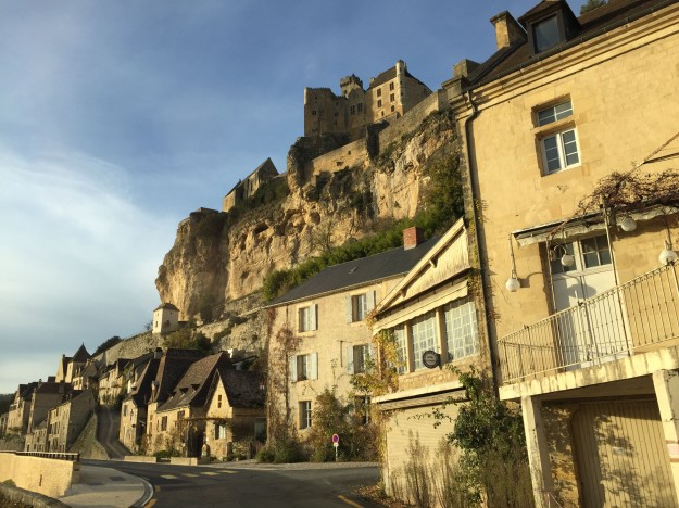
The following morning we awoke to a light frost, the frosty whiteness sticking all the loose fallen leaves to the picnic table beside us.  We got moving reasonably early, with a plan to jump over to the next beau village, La Roque-Gageac, only a handful of miles along the valley floor.  We soon arrived and parked up, before walking first to the banks of the passing river to take in the wonderful reflective view of the town’s collective façade.  We slowly traced a path along the front, enjoying the setting and the stillness.  Huge rugged limestone cliffs protected the village that clung to its face from behind, and almost camouflaged it from the front.  We found a narrow, stoned path leading steeply up through the buildings, to reach a local access road behind that offered panoramic views across the valley.

La Roque-Gageac (backstreets)

La Roque-Gageac (view to river)

La Roque-Gageac (ivy doorway)

We passed tall cypress trees, fluffy pampas grass and neat timber doorways lined with red ivy, leading into stone houses balanced on the steep slopes.  We saw a church, a château, several circular corner turrets on ivy-covered buildings made from the same stone as the cliff.  The clear day gave us exceptional views along the river in both directions, and back to Domme, sat high on the hillside. We reached the Hogwarts-looking school at the end of town and returned slowly along the pretty front, between the main façade and the fast-flowing Dordogne River.  The village setting was quite spectacular and we never tired of looking at it under the hazy glow of the morning sun.

La Roque-Gageac (river facade)

We backtracked a little to the village of Cénac, to buy some bread for lunch, before returning back through La Roque-Gageac and beyond, to have a look at a nearby aire.  It was €15, sparse and right on the road, so we decided to push on a little further rather than lingering in this valley.  It was still early and we had not moved far, only a few miles, so felt we should go further.  Besides, we still had one more place to visit today – Les jardins de Marqueyssac.  

France – Groléjac & Sarlat-la-Canéda

After leaving the incredible, balancing beauty of Rocamadour we soon had to turn and back-track a little.  Our first chosen route out of town was closed for remedial works, so we chose a smaller, windier route over bumpy hills and through the open countryside.  It was a warm, clear morning and a quite beautiful choice, thickly lined with tall yellow trees lit up in the morning sun, and we loudly sung its praises as we rolled along it mile after wonderful mile.

Carsacaillac (abbey building)

As we were passing, we paid a flying visit to the small town of Souhillac.   We stopped in their central aire for ease of parking, before walking around the centre, seeing the Sainte-Marie Abbaye de Souillac.  The impressive Romanesque building was constructed in the 11th and 12th centuries with a triple-domed chevet. The floor plan is a traditional Latin cross, said to have been inspired by Haghia Sophia in Istanbul.  We circled the abbey and a portion of the old town, enjoying stretching our legs.  The tourist office was shut, as expected in low season, but we were still able to use the town’s free Wi-Fi to update our downloaded off-line maps.  We sat on the ground in a small patch of warm sun in a pretty square deep with yellow, fallen leaves.  As we utilised the free Wi-Fi we watched the antics of a group of young French girls, posing and smoking to look as cool as possible as they chatted loudly in incomprehensible (to us) French.

Carsacaillac (town streets)

We had planned to stay in Carsac-Aillac, but when we parked on the aire we got stuck fast on the grass, each attempt to move dug ourselves ever deeper into a literal hole.  We tried six times to roll a little further back, in the hope we could find solid ground and gain traction, but only put ourselves into more grief, further down the grassy slope.  With one final endeavour, with chocks kicked solidly behind our front wheels, we rolled a little back onto each chock then drove off with a short, grippy start.  Each try gained us a half metre, then chocks were reset and we went again.  After numerous attempts we finally escaped and Benny regained sure footing on the flat gravel.  We had practically destroyed an area of their grass, churning it up in a myriad of places.  There was no one around so we tidied what we could then sheepishly made a swift exit.  Never before did we have so much relief in being able to drive off a site.

Grolejac - free aire

Grolejac (riverbank and bridge)

We guiltily drove on to a different aire, at the nearby hamlet of Groléjac.  This proved such a contrast – a free aire with services, set out on a spacious plot with large individual bays formed in neat limestone gravel separated by well-tended strips of grass.  We were the only motorhome in residence, and we felt very glad to have such a nice alternative so close by – the beauty of travelling by motorhome in welcoming France.  We had a short walk locally to see the nearby village and the river frontage.  We found the road bridge and later, following the riverbank west alongside neat woodland and planted coppices, the old steel railway bridge, part of a long cycle path on the old train route. We saw a dog-obstacle course being well-used by trainers as we followed the fast-flowing Dordogne to eye-up a spot listed in our Wild Swimming France book, but found the water was much too wild to contemplate a swim.

Grolejac (dordogne valley)

Grolejac (az with bridge)

Grolejac (coppices)

The original reason we had looked to stop in Carsac-Aillac was to cycle the local voie verte route, an old train line now designated as a cycle path, leading into the regional town of Sarlat-la-Canéda.  Fortunately, the very same route continued along into Groléjac, so we could easily complete the same cycle from our new home, with even a few extra miles of track to enjoy.  The forecast was looking much better for the following day so we procrastinated, leaving off from contemplating the cycle until then.  Instead we passed the afternoon mooching around the aire, with another short wander in the early evening sunset hours.  We relaxed, had a slow sumptuous dinner and later opened a bottle of red as we re-watched the feel-good movie ‘A Good Year’ for a welcome shot of French longing.

Sarlat-la-caneda (n on bridge)

Sarlat-la-caneda (n on vioe verte)

Sarlat-la-caneda (bikes at rest)

We welcomed the morning with a big fry-up, a rarity for us, as despite the shining sun above us the day was going to be very cold. We wrapped up warm and headed along the voie verte and across the pedestrian bridge in the direction of Sarlat.  The route passed through passages of autumnal trees, bending over tunnel-like to enclose the path, but thinned just enough to allow shafts of light to penetrate and dance on the fallen leaves.  We passed deep gorges dynamited out of rock to allow the passage of the original train-line.  The voie verte ran out near to the centre of Sarlat town, so we had to make our own way from there.  Rather than following the busy traffic road into town, we chose to head up and over a steep hill, a tough winding climb, then had a brake-melting descent down a narrow weedy path, popping out close to the medieval centre of Sarlat-la-Canéda.

Sarlat-la-caneda (main square buildings)

Sarlat-la-caneda (specialist shops)

There were Christmas market stalls and cabins in the process of being constructed, and lights in the process of being hung.  The streets in the centre were quiet of cars and had pedestrian priority even though some cars were allowed through.  We abandoned our bikes in a quiet corner by an Artisan foie gras and wine store and continued on foot.  The old medieval centre was a delight; speciality stores selling leather goods and local foods were integrated neatly into the ancient stone buildings, leading shoppers and browsers around through narrow alleyways and passages, past churches and numerous small bronze statues.  We passed through the huge grey steel doors, fifteen metres high, of the covered marketplace for a browse of the colourful stalls.  It was a beautiful town, very neat and inviting.

Sarlat-la-caneda (central square)

Sarlat-la-caneda (leafy cycle path)

We returned by the same leafy route, only realising on the return leg how much we’d worked rising along a gentle incline all the way into Sarlat.  We hardly had to pedal going back to Groléjac, so we had lots of heads-up time to fully enjoy the surrounding views as we mostly free-wheeled home through the glorious trees.  We spent another quiet night alone in the peaceful aire, looking out to an all-encompassing black blanket filled with twinkling stars.

France – Rocamadour and the GR6

Leaving our misty valley view in Autoire, we first stopped at services at nearby Gramat to fill up with fresh water.  It was the time of year taps were beginning to be turned off, for fear of freezing, so we filled up when we could.  A quick supermarket stop and we were all fully set, so we headed out along the pretty country roads towards Rocamadour.

Rocamadour (misty start)

Rocamadour (church buildings)

We arrived at the large car-park at the top of the hill, by the terminal of the funicular that carries visitors down the mountain.  After a little deliberation on whether the aire was actually open, we parked up alone in the huge gravel area by the closed campsites and readied ourselves for exploring.  We first walked to the château, then the cross at the top of the cliff, before starting down the stone paths leading to the medieval town.  The winding hairpin route was slippery with the build-up of wet fallen leaves and we had to be rather careful, so made slow progress.  Each corner turn had an icon for pilgrims to view or rest at as they passed, and one expansive plateau between two paths housed an area of intricately carved columns with decorative statuary, all seemingly created out of the cliff face.

Rocamadour (cliff tombs)

Rocamadour (buildings)

Dropping down quickly under the cover of yellowed trees, we soon arrived at the Sanctuary of the Blessed Virgin Mary and its complex maze of ancillary buildings, all built on or into the cliff face.  This was a 12th century Benedictine community precariously perched on the face of the cliff, about halfway up, with the community village below.  We could just see the Alzou river, flowing between limestone cliffs over 120 metres high, between the red-amber foliage of the blanket of overhanging valley trees. Long, straight runs of carved stone steps led us on, ever downwards.  When we reached the village at the bottom of the cliff, it was almost entirely empty, the early hour and the dour weather having scared off all but the most dedicated tourists.  We walked the length of the narrow, winding main street, far enough to see the tall château, built to help defend the sanctuary, balanced on the high plateau of the rocky cliff behind.

Rocamadour (valley view)

GR6 – walk

More dull drizzle welcomed us on Sunday morning, lightly tapping on Benny’s roof.  After a slow start to see if the inclement weather would clear, we noticed a slight brightening and finally decided to get on with our day and go explore beyond Rocamadour town.  With our walking boots and waterproofs on, we headed off feeling sure we would spend a good portion of the day getting wet.  We enjoyed re-visiting the beautiful tree-lined hairpin decent past the château and down towards the medieval town.  We passed through the stone tunnel and the grounds of the sanctuary church complex built up against the rock face, before descending the main stone stairway to reach the edge of town.  From here we headed west out of town on the well-marked Grand Randonnee 6, or GR6 for short.  This dedicated walking route was to be our main companion for the day, through the beautiful valley forests.

Rocamadour (arch at end of town)

Gouffre de Saint Sauveur (autumn)

Our spirits were lifted by the beauty of the autumnal leaves on the many trees lining the valley floor and sides of this limestone gorge.  Our route along the gorge’s valley floor curved in harmony with our neighbour, the meandering L’Alzou river.  We followed an easy trail through intensely beautiful scenery, even when viewed through the persistent drizzle.  This led us first to a deep sink hole, named le Gouffre de Cabouy, where several dry-suited divers were preparing to descend into the passageways below.  This over-ground limestone gorge covers a network of many underground caverns and connected stretches of labyrinthine tunnels. We continued around the edges of the blue pool and onwards to our planned destination of le Gouffre de Saint Sauveur, a stunning swim spot recommended in our Wild Swimming France book.

Gouffre de Saint Sauveur (arrival)

Gouffre de Saint Sauveur (sinkhole)

The promise of crystal clear, azure water on a warm sunny summer day was conjured up easily in our minds, but on this damp November day, although pretty with the autumn colours of the surrounding woodland blanketing its high cauldron backdrop, the pool was slightly lacklustre in comparison to the one of our imaginations.  The surface was partially covered with algae and fallen leaves, so neither the depth of colour nor visibility was pristine. There were canyon divers here too, their presence foretold by giveaway bubbles, and we sat and ate some snacks as we waited for them to slowly resurface from the blue depths.  Once they had waddled out in their fins and returned to their cars, we had the pool entirely to ourselves, and Nicky prepared herself for a dip.  I opted out for once, becoming the designated towel-holder and cameraman as Nicky wriggled into her swimsuit and rash vest and slowly eased her feet along the gradually sloping sandy bottom to reach the blue water of the deeper part of the pool.

Gouffre de Saint Sauveur (ready for swim)

Gouffre de Saint Sauveur (in the sink)

Nicky reports:  So many times we’ve visited a place in winter months and have agreed how lovely the place would be in the summer; here was no exception.  Yet visual beauty was only one way to seduce your senses.  After a summer of enjoying many Scandinavian swims, whether wetsuit or birthday suit, quick dip or lengthy training swim, it had been a long while since we had been immersed.  When swimming skins on a cool, wet November day you anticipate the biting temperature of the water grabbing your skin and enveloping you in a tightly-hugging chill.  This somewhat sadistic feeling is ultimately invigorating, refreshing and pleasurable all at once, a nerve-tingling thrill and a sensory overload.  It’s even more special when coupled with a deep natural pool in rural French countryside, surrounded by overhanging autumnal trees, reached by a lovely, lingering 7km hike.  All other thoughts in your mind are banished as the enlivening feeling from the cold water accompanies you in a tranquil cocooning haven; a special moment.

Rocamadour (on the GR6 path)

With Nicky dried off and suitably re-clothed, we returned by the same path back to Rocamadour.  The winter scenery continued to impress through a dull light drizzle that turned into a heavy deluge seconds after we made it back to Benny.  Happy to have made something of an otherwise washout of a day we snuggled cosily inside, content with our efforts, and enjoyed many cups of warming tea.  It would have been so easy to stay in and miss out on creating this wonderful memory.

France – Turenne & Collonges-La-Rouge

We serviced and left the pretty hilltop aire in Dampniat, heading across country.  The weather had turned and we no longer enjoyed wonderfully clear blue skies, but a dull, thick greyness now permeated everything, blocking out the light.  A light drizzle occasionally fell, obscuring our view as much as the lack of light did, making it a fairly miserable, grey day for sight-seeing and photography.  But we persisted with our plan, and next to see was Turenne.

Turenne (village square)

Turenne (village streets)

Turenne is bastide village, one built in a circular plan on a domed hill, historically providing both prestige and security for the residents. We arrived on the outskirts and slowly inched our way down a tight lane into the town’s aire, amazed to see a huge 9m long Concorde parked up already, with no idea of how he manged to turn himself into the site. We weren’t staying so parked at the back of the aire, away from the free electricity points, and walked into the town.  The sky was a uniform blankness, an off-white sheet of featureless cloud.  Even with the lack of light on this overcast day, the first square we reached, less than a minute from the aire, was simply beautiful.  The town’s white stone mixed with a pale hanging mist gave an ethereal quality to the buildings, and they oozed class and eminence.

Turenne (Az in narrow street)

Turenne (n wandering the streets)

We walked along narrow streets lined with colour-giving hanging baskets, all neatly tended even this late in the year. It was so tranquil, out of season, casually wandering and envisioning the lives of those who had passed through these gates in ancient times, and similarly imagining what it must be like to live in this village today.  Turenne had very difficult and tight access for cars and would certainly be hard to cycle to and from. We continued uphill to reach the main castle, passing many private homes and gîtes for hire, some with tiny swimming pools.  Several balconies offered expansive views down over the valley and the lower portions of the town.  The view was mostly shrouded in low-lying mist, but the occasional stray breath of wind would momentarily clear the obstruction and allow us a look.

Turenne (view of valley below)

Collonges-la-rouge (approaching village)

Collonges-la-rouge (N in village)

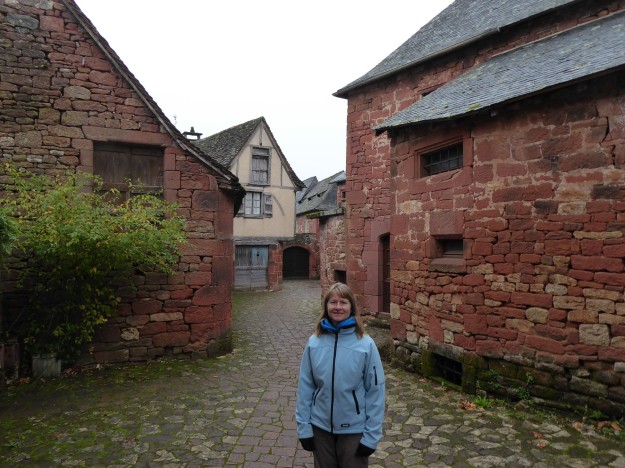
We returned to the aire and carefully headed on, ready for our next stop at nearby Collonges-la-Rouge.  This was yet another place with the designation of ‘Beau Village’ and we soon felt it richly deserved its classification.  There was a dedicated motorhome aire on the outskirts, and we walked in from there, slightly unsure if we needed to pay.  Our approach offered an overview of the town from a distance, and of several route options we could take.  The dark red sandstone of all of the buildings in the well-preserved small town was almost burgundy in colour.  Sadly, it cast a deeper pastel shade than normal under dull, blank skies and although we were sure we weren’t seeing it at its best, the intricate narrow streets full of many bespoke quaint homes and local artisan businesses was still a delight to see.

Collonges-la-rouge (church exterior)

Collonges-la-rouge (church interior)

Collonges-la-rouge (Az under arch)

The village can historically be traced to the 8th century CE, but has had a rather chequered history. It profited and grew from the custom of pilgrims passing through the nearby pilgrimage site of Rocamadour, but the French revolution caused the destruction of key priory buildings.  It underwent a brief economic recovery in the 19th century until dwindling population numbers led the village to becoming not much more than a stone quarry.  Only in the early 20th century did villagers create a movement that eventually secured the classification of the village as an important historic monument.  Collonges-la-Rouge was the founding member of the ‘Les Plus Beaux Villages de France’ association, a brainchild of the mayor, and has since become one of the most visited places in the region.

Collonges-la-rouge (leafy streets)

Collonges-la-rouge (central towers)

Collonges-la-rouge (n walking the centre))

The village was like a perfect film set; each twist of the pathway, every turn of a street corner, brought a new vista of beauty and interest even on this, the dullest of days.  Red and yellow-leafed ivy hung off the high sandstone walls in beautiful cascading curtains, adding a softening aged grandeur.  Most of the village’s commerce was closed, but we passed one restaurant whose vents were expelling the most wonderful aromas.  We had read that the sandstone is known to glow brightly under a warm sun and we vowed to revisit at a future time to experience this.  Collonges-la-Rouge had a tight, compact centre and we completed various loops to ensure we’d walked every possible path and seen all the key buildings from all angles, absorbing the sights as much as we could during our all too brief visit.

Domaine du Chirac (duck house camper)

Domaine du Chirac (With our purchase)

We planned to overnight stop at a nearby farm­, but it proved difficult to find as the co-ordinates listed on their website led only to the centre of the nearby village of Brivezac.  We eventually found Domaine du Chirac on Google maps and plotted our own route, only we headed up and over the mountain on single track farm roads, rather than around on proper roads.  We would have faced trouble had we met another vehicle on the way, but thankfully we didn’t.  This was a France Passion business, a local wine producer, and we were able to both park up for the night and enjoy a wine tasting.  Their specialty was rich, sweet white wine, which isn’t a particular favourite, but we enjoyed the tasting session and learning a little of the history of their business.  We purchased a bottle to serve as a sweet aperitif at our upcoming Christmas festivities, before settling in surrounded by geese, donkeys and farm dogs.

France – Dampniat & Brive-la-Gaillarde

We moved on from our visit to Saint-Robert to reach the rural heights of the village of Dampniat.  We had a worrying moment on our arrival, as pulling up at the aire we faced a chain across with INTERDIT in bold letters.  We soon worked out that this was only closing off the large area of the aire on the right, with the opposite smaller side, only large enough for three motorhomes, still available for us to use.  It seemed they were in the dubious process of marking the larger area into specific individual bays, as if the French pay any heed to them when parking.

Dampniat (village at sunset)

Dampniat (n watching sunset)

All services, including free electricity, were happily on hand, so we parked up in the corner, plugged in and relaxed with our heating blasting.  It was set to drop to -2C overnight, so we were glad to have the hook-up, and at our favourite price – thanks, Dampniat.  We had a stroll around the small settlements on the nearby hills before dinner, enjoying great views out over rolling countryside turned red under the setting sun.  The roads were empty the entire walk and only the odd dog barking penetrated the rural silence.  But when the sun went down, it was like a heavy cloak of impenetrable blackness descended everywhere, unlike any we had seen, or more accurately not seen, in a long time.

Dampniat - benny in aire

Dampniat - readyy for cycle

We awoke to face a bitterly cold morning, with a light frost on the grass outside.  The view across to the village of Dampniat was lit with a bright sun-rising redness, similar to the previous night’s sunset.  The sky was clear of any cloud cover and held the potential for a sunny dry day, so we proceeded with our plan to finally utilise our bikes and cycle down into the nearby centre of Brive-la-Gaillarde, the main town in this region of villages.  We wrapped up warm and set off, downhill through villages and forests.  It was a steep descent, passing by lots of houses but very few vehicles, until we reached the valley floor near the town and the traffic increased massively.  By then, we were rewarded with the use of dedicated cycle lanes so cars were not an issue as we made our way along to the centre of Brive.

Brive-la-Gaillarde (cental buildings)

Brive-la-Gaillarde (town hall)

We headed straight for the heart of the medieval centre, picking out the tall church tower we could see all the way in.  It sat in a small square, lined by very pretty red-leafed trees that contrasted with the church’s stone. This local yellow sandstone dominated most of the historic centre, with many key buildings being built from it.  The stone lit up to glow when in direct sun.  Away from the tiny, medieval streets, the town centre was bustling with busy shoppers, and we had to be slow and careful picking our way through pedestrians.  We watched long, colourful runs of Christmas lights being put up by men in a cherry-picker, the road through to the central square having been closed to vehicles to allow them to work. Seasonal markets were in the process of being set up, and all felt very festive.

Brive-la-Gaillarde (church square)

Brive-la-Gaillarde (pretty parkland)

Brive-la-Gaillarde (low river)

Beautiful stone high-ceilinged townhouses, each with a private gated front garden, lined the grand streets on the peripheral of the medieval centre. We passed them as we looped around the centre, dodging down many small side streets to get a quick impression of the town.  It looked pretty, lively, full to bursting with interesting corners and modern conveniences.  We found the tourist office by the bus-station and collected a few local maps, before heading across to the park that sat adjacent to the river.  It was a neat, leafy park, but the river had the appearance of having been abandoned, forgotten, or at least not particularly celebrated by the town.  The town centre seemed to have turned its back on it, and it looked rather forlorn, with many weeds and a low volume of flowing water.

Brive-la-Gaillarde (Az in park)

Brive-la-Gaillarde (n relaxing in park)

Brive-la-Gaillarde (leaving town)

We had been dreading the cycle back home, so we mooched about, putting off the long hill climb off for as long as possible.  We’d not cycled for a while, and were unsure how our legs would react to the protracted rise.  Instead of returning by the same road we had descended, we found an off-road cycle path that followed the river out of town in the general direction (east) we needed, rolling though beautiful forest trails.  We had a few sharp climbs on the route, and each time we thought that we were into the climb, but we kept being given a fast, exciting downhill that we couldn’t allow ourselves to fully enjoy with the ever-nagging reminder that we were giving away hard-gained metres that we would have to climb all over again.  But the path was fantastic, flowing along fast beside the river.

Brive-la-Gaillarde (riverside cycle)

Brive-la-Gaillarde (river paths)

Brive-la-Gaillarde (hill climb return)

Rather than a gently rising 11km road back up to Dampniat we now, approaching from a different direction, faced a much shorter and sharper 4km long rise, with hairpins and spectacular views.  We rolled up it slowly, but in relative comfort, quite happy our legs and lungs were still able to respond to the occasion.  When we arrived back in Dampniat we were left wondering what we’d been so worried about, and enjoyed the last few hundred metres downhill back to the aire.  We passed a fun afternoon completing charcoal drawings of each other’s facial features, each attempt allowed a maximum of five minutes on the stopwatch.  We’ll not share the results, but it is fair to say that not all the sketches were equally successful.  We passed another quiet night in the aire, relaxing in the warmth and comfort of Benny.